Ribemont
| Ribemont | ||
|---|---|---|
|
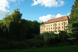
Lucy mill | ||
| ||
 Ribemont | ||
|
Location within Hauts-de-France region  Ribemont | ||
| Coordinates: 49°47′47″N 3°27′33″E / 49.7964°N 3.4592°ECoordinates: 49°47′47″N 3°27′33″E / 49.7964°N 3.4592°E | ||
| Country | France | |
| Region | Hauts-de-France | |
| Department | Aisne | |
| Arrondissement | Saint-Quentin | |
| Canton | Ribemont | |
| Intercommunality | Vallée de l'Oise | |
| Government | ||
| • Mayor (2008–2014) | Michel Potelet | |
| Area1 | 26.91 km2 (10.39 sq mi) | |
| Population (2012)2 | 1,966 | |
| • Density | 73/km2 (190/sq mi) | |
| Time zone | CET (UTC+1) | |
| • Summer (DST) | CEST (UTC+2) | |
| INSEE/Postal code | 02648 / 02240 | |
| Elevation |
62–141 m (203–463 ft) (avg. 67 m or 220 ft) | |
|
1 French Land Register data, which excludes lakes, ponds, glaciers > 1 km² (0.386 sq mi or 247 acres) and river estuaries. 2 Population without double counting: residents of multiple communes (e.g., students and military personnel) only counted once. | ||

Ribemont is a commune in the Aisne department in Hauts-de-France in northern France.
Population
| Historical population | ||
|---|---|---|
| Year | Pop. | ±% |
| 1793 | 2,500 | — |
| 1800 | 2,330 | −6.8% |
| 1806 | 2,316 | −0.6% |
| 1821 | 2,547 | +10.0% |
| 1831 | 2,726 | +7.0% |
| 1836 | 2,716 | −0.4% |
| 1841 | 2,791 | +2.8% |
| 1846 | 3,098 | +11.0% |
| 1851 | 3,098 | +0.0% |
| 1856 | 3,028 | −2.3% |
| 1861 | 3,132 | +3.4% |
| 1866 | 3,126 | −0.2% |
| 1872 | 3,124 | −0.1% |
| 1876 | 3,096 | −0.9% |
| 1881 | 3,195 | +3.2% |
| 1886 | 3,129 | −2.1% |
| 1891 | 2,935 | −6.2% |
| 1896 | 2,847 | −3.0% |
| 1901 | 2,769 | −2.7% |
| 1906 | 2,627 | −5.1% |
| 1911 | 2,584 | −1.6% |
| 1921 | 2,142 | −17.1% |
| 1926 | 2,186 | +2.1% |
| 1931 | 2,020 | −7.6% |
| 1936 | 1,976 | −2.2% |
| 1946 | 1,813 | −8.2% |
| 1954 | 1,967 | +8.5% |
| 1962 | 2,187 | +11.2% |
| 1968 | 2,152 | −1.6% |
| 1975 | 2,014 | −6.4% |
| 1982 | 2,105 | +4.5% |
| 1990 | 2,227 | +5.8% |
| 1999 | 2,096 | −5.9% |
| 2008 | 2,023 | −3.5% |
| 2012 | 1,966 | −2.8% |
See also
References
| Wikimedia Commons has media related to Ribemont. |
This article is issued from Wikipedia - version of the 11/8/2016. The text is available under the Creative Commons Attribution/Share Alike but additional terms may apply for the media files.