Canteloup, Manche
| Canteloup | |
|---|---|
|
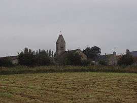
The church of Saint-Martin | |
 Canteloup | |
|
Location within Normandy region  Canteloup | |
| Coordinates: 49°38′47″N 1°21′03″W / 49.6464°N 1.3508°WCoordinates: 49°38′47″N 1°21′03″W / 49.6464°N 1.3508°W | |
| Country | France |
| Region | Normandy |
| Department | Manche |
| Arrondissement | Cherbourg |
| Canton | Val-de-Saire |
| Intercommunality | Communauté de communes de Saint-Pierre-Église |
| Government | |
| • Mayor (2008–2014) | Jean Mangon |
| Area1 | 4.28 km2 (1.65 sq mi) |
| Population (2006)2 | 173 |
| • Density | 40/km2 (100/sq mi) |
| Time zone | CET (UTC+1) |
| • Summer (DST) | CEST (UTC+2) |
| INSEE/Postal code | 50096 / 50330 |
| Elevation |
55–124 m (180–407 ft) (avg. 120 m or 390 ft) |
|
1 French Land Register data, which excludes lakes, ponds, glaciers > 1 km² (0.386 sq mi or 247 acres) and river estuaries. 2 Population without double counting: residents of multiple communes (e.g., students and military personnel) only counted once. | |
Canteloup is a commune in the Manche department in Normandy in north-western France.
See also
| Wikimedia Commons has media related to Canteloup, Manche. |
This article is issued from Wikipedia - version of the 7/5/2016. The text is available under the Creative Commons Attribution/Share Alike but additional terms may apply for the media files.