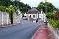
Chissay-en-Touraine
| Chissay-en-Touraine | |
|---|---|
|
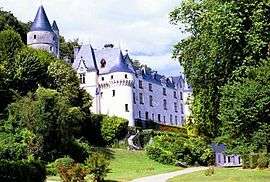
Château de La Ménaudière | |
 Chissay-en-Touraine | |
|
Location within Centre-Val de Loire region  Chissay-en-Touraine | |
| Coordinates: 47°20′17″N 1°08′02″E / 47.3381°N 1.1339°ECoordinates: 47°20′17″N 1°08′02″E / 47.3381°N 1.1339°E | |
| Country | France |
| Region | Centre-Val de Loire |
| Department | Loir-et-Cher |
| Arrondissement | Blois |
| Canton | Montrichard |
| Intercommunality | Du Cher à la Loire |
| Government | |
| • Mayor (2014–2020) | Philippe Plassais |
| Area1 | 18.17 km2 (7.02 sq mi) |
| Population (2013)2 | 1,164 |
| • Density | 64/km2 (170/sq mi) |
| Time zone | CET (UTC+1) |
| • Summer (DST) | CEST (UTC+2) |
| INSEE/Postal code | 41051 / 41400 |
| Elevation |
55–138 m (180–453 ft) (avg. 63 m or 207 ft) |
|
1 French Land Register data, which excludes lakes, ponds, glaciers > 1 km² (0.386 sq mi or 247 acres) and river estuaries. 2 Population without double counting: residents of multiple communes (e.g., students and military personnel) only counted once. | |
Chissay-en-Touraine is a commune in the Loir-et-Cher department of central France.
Population
| Historical population | ||
|---|---|---|
| Year | Pop. | ±% |
| 1793 | 864 | — |
| 1806 | 883 | +2.2% |
| 1821 | 1,022 | +15.7% |
| 1831 | 1,028 | +0.6% |
| 1841 | 1,091 | +6.1% |
| 1851 | 1,056 | −3.2% |
| 1861 | 1,060 | +0.4% |
| 1872 | 1,093 | +3.1% |
| 1881 | 1,134 | +3.8% |
| 1891 | 1,017 | −10.3% |
| 1901 | 1,028 | +1.1% |
| 1911 | 991 | −3.6% |
| 1921 | 909 | −8.3% |
| 1931 | 866 | −4.7% |
| 1946 | 870 | +0.5% |
| 1954 | 891 | +2.4% |
| 1962 | 846 | −5.1% |
| 1968 | 856 | +1.2% |
| 1975 | 850 | −0.7% |
| 1982 | 846 | −0.5% |
| 1990 | 871 | +3.0% |
| 1999 | 916 | +5.2% |
| 2008 | 1,113 | +21.5% |
| 2013 | 1,164 | +4.6% |
See also
References
 Chissay-en-Touraine
| Wikimedia Commons has media related to Chissay-en-Touraine. |
This article is issued from Wikipedia - version of the 11/12/2016. The text is available under the Creative Commons Attribution/Share Alike but additional terms may apply for the media files.