Vievy-le-Rayé
| Vievy-le-Rayé | ||
|---|---|---|
|
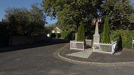
The war memorial in Vievy-le-Rayé | ||
| ||
 Vievy-le-Rayé | ||
|
Location within Centre-Val de Loire region  Vievy-le-Rayé | ||
| Coordinates: 47°51′57″N 1°18′54″E / 47.8658°N 1.315°ECoordinates: 47°51′57″N 1°18′54″E / 47.8658°N 1.315°E | ||
| Country | France | |
| Region | Centre-Val de Loire | |
| Department | Loir-et-Cher | |
| Arrondissement | Blois | |
| Canton | Ouzouer-le-Marché | |
| Area1 | 45.12 km2 (17.42 sq mi) | |
| Population (1999)2 | 461 | |
| • Density | 10/km2 (26/sq mi) | |
| Time zone | CET (UTC+1) | |
| • Summer (DST) | CEST (UTC+2) | |
| INSEE/Postal code | 41273 / 41290 | |
| Elevation |
99–152 m (325–499 ft) (avg. 125 m or 410 ft) | |
|
1 French Land Register data, which excludes lakes, ponds, glaciers > 1 km² (0.386 sq mi or 247 acres) and river estuaries. 2 Population without double counting: residents of multiple communes (e.g., students and military personnel) only counted once. | ||
.svg.png)
Vievy-le-Rayé is a commune in the Loir-et-Cher department in central France.
It includes the former commune of La Bosse.
Demographics
| Year | 1962 | 1968 | 1975 | 1982 | 1990 | 1999 |
|---|---|---|---|---|---|---|
| Population | 553 | 618 | 575 | 500 | 469 | 461 |
See also
| Wikimedia Commons has media related to Vievy-le-Rayé. |
This article is issued from Wikipedia - version of the 3/2/2015. The text is available under the Creative Commons Attribution/Share Alike but additional terms may apply for the media files.