Contres, Loir-et-Cher
| Contres | ||
|---|---|---|
|
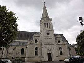
Church of Saint-Cyr and Sainte-Julitte | ||
| ||
 Contres | ||
|
Location within Centre-Val de Loire region  Contres | ||
| Coordinates: 47°25′11″N 1°25′43″E / 47.4197°N 1.4286°ECoordinates: 47°25′11″N 1°25′43″E / 47.4197°N 1.4286°E | ||
| Country | France | |
| Region | Centre-Val de Loire | |
| Department | Loir-et-Cher | |
| Arrondissement | Blois | |
| Canton | Contres | |
| Intercommunality | Controis | |
| Government | ||
| • Mayor (2014–2020) | Jean Luc Brault | |
| Area1 | 36.09 km2 (13.93 sq mi) | |
| Population (2013)2 | 3,530 | |
| • Density | 98/km2 (250/sq mi) | |
| Time zone | CET (UTC+1) | |
| • Summer (DST) | CEST (UTC+2) | |
| INSEE/Postal code | 41059 / 41700 | |
| Elevation |
94–129 m (308–423 ft) (avg. 100 m or 330 ft) | |
|
1 French Land Register data, which excludes lakes, ponds, glaciers > 1 km² (0.386 sq mi or 247 acres) and river estuaries. 2 Population without double counting: residents of multiple communes (e.g., students and military personnel) only counted once. | ||

Contres is a commune in the Loir-et-Cher department of central France.
Population
| Historical population | ||
|---|---|---|
| Year | Pop. | ±% |
| 1793 | 1,317 | — |
| 1806 | 1,202 | −8.7% |
| 1821 | 1,571 | +30.7% |
| 1831 | 1,755 | +11.7% |
| 1841 | 2,166 | +23.4% |
| 1851 | 2,575 | +18.9% |
| 1861 | 2,601 | +1.0% |
| 1872 | 2,553 | −1.8% |
| 1881 | 2,493 | −2.4% |
| 1891 | 2,591 | +3.9% |
| 1901 | 2,649 | +2.2% |
| 1911 | 2,543 | −4.0% |
| 1921 | 2,421 | −4.8% |
| 1931 | 2,452 | +1.3% |
| 1946 | 2,702 | +10.2% |
| 1954 | 2,551 | −5.6% |
| 1962 | 2,775 | +8.8% |
| 1968 | 2,828 | +1.9% |
| 1975 | 2,811 | −0.6% |
| 1982 | 2,923 | +4.0% |
| 1990 | 2,979 | +1.9% |
| 1999 | 3,268 | +9.7% |
| 2008 | 3,407 | +4.3% |
| 2013 | 3,530 | +3.6% |
See also
References
| Wikimedia Commons has media related to Contres (Loir-et-Cher). |
This article is issued from Wikipedia - version of the 11/14/2016. The text is available under the Creative Commons Attribution/Share Alike but additional terms may apply for the media files.