Lunay
| Lunay | ||
|---|---|---|
|
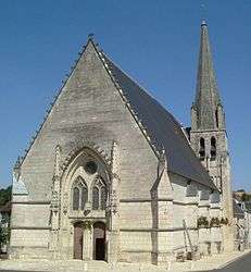
The church of Saint-Martin, in Lunay | ||
| ||
 Lunay | ||
|
Location within Centre-Val de Loire region  Lunay | ||
| Coordinates: 47°48′36″N 0°54′57″E / 47.81°N 0.9158°ECoordinates: 47°48′36″N 0°54′57″E / 47.81°N 0.9158°E | ||
| Country | France | |
| Region | Centre-Val de Loire | |
| Department | Loir-et-Cher | |
| Arrondissement | Vendôme | |
| Canton | Savigny-sur-Braye | |
| Intercommunality | Pays de Vendôme | |
| Government | ||
| • Mayor (2001–2008) | Sébastien Miralvès | |
| Area1 | 38.63 km2 (14.92 sq mi) | |
| Population (1999)2 | 1,293 | |
| • Density | 33/km2 (87/sq mi) | |
| Time zone | CET (UTC+1) | |
| • Summer (DST) | CEST (UTC+2) | |
| INSEE/Postal code | 41120 / 41360 | |
| Elevation |
66–156 m (217–512 ft) (avg. 69 m or 226 ft) | |
|
1 French Land Register data, which excludes lakes, ponds, glaciers > 1 km² (0.386 sq mi or 247 acres) and river estuaries. 2 Population without double counting: residents of multiple communes (e.g., students and military personnel) only counted once. | ||
.svg.png)
Lunay is a commune in the Loir-et-Cher department of central France.
Its inhabitants are known as Lunotiers.
Geography
Lunay is located 15 km (9.3 mi) west of the city of Vendôme, in the northwest of the département and 180 km southwest of Paris. The Loir River flows along the east and south edges of the commune for 8 km.
Lunay is bordered by Thoré-la-Rochette, Mazangé, Fortan, Savigny-sur-Braye, Fontaine-les-Coteaux, Montoire-sur-le-Loir, Les Roches-l'Évêque, and Saint-Rimay.
Demographic history
| 1831 | 1901 | 1954 | 1962 | 1968 | 1975 | 1982 | 1990 | 1999 |
|---|---|---|---|---|---|---|---|---|
| 1,596 | 1,569 | 1,142 | 937 | 1,011 | 1,007 | 1,207 | 1,213 | 1,293 |
| Census count starting from 1962 : Population without double counting | ||||||||
See also
External links
| Wikimedia Commons has media related to Lunay. |
- Official Web site (French)
- Lunay football (French)
- Lunay on the IGN Web site (French)
- Lunay on the INSEE Web site (French)
- Lunay on the Quid Web site (French)
- Communes surrounding Lunay (French)
- Lunay on the map of France (French)
- Map of Lunay on Mapquest
This article is issued from Wikipedia - version of the 2/12/2016. The text is available under the Creative Commons Attribution/Share Alike but additional terms may apply for the media files.