Lancôme, Loir-et-Cher
| Lancôme | |
|---|---|
 | |
 Lancôme | |
|
Location within Centre-Val de Loire region  Lancôme | |
| Coordinates: 47°38′59″N 1°07′27″E / 47.6497°N 1.1242°ECoordinates: 47°38′59″N 1°07′27″E / 47.6497°N 1.1242°E | |
| Country | France |
| Region | Centre-Val de Loire |
| Department | Loir-et-Cher |
| Arrondissement | Blois |
| Canton | Herbault |
| Intercommunality | Beauce - Val de Cisse |
| Government | |
| • Mayor (2014–2020) | Claudette Bourgueil |
| Area1 | 9.89 km2 (3.82 sq mi) |
| Population (2013)2 | 128 |
| • Density | 13/km2 (34/sq mi) |
| Time zone | CET (UTC+1) |
| • Summer (DST) | CEST (UTC+2) |
| INSEE/Postal code | 41108 / 41190 |
| Elevation |
105–129 m (344–423 ft) (avg. 118 m or 387 ft) |
|
1 French Land Register data, which excludes lakes, ponds, glaciers > 1 km² (0.386 sq mi or 247 acres) and river estuaries. 2 Population without double counting: residents of multiple communes (e.g., students and military personnel) only counted once. | |
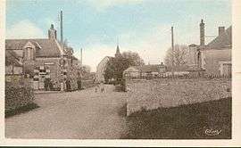
Lancôme is a commune in the Loir-et-Cher department of central France.
Population
| Historical population | ||
|---|---|---|
| Year | Pop. | ±% |
| 1793 | 162 | — |
| 1806 | 176 | +8.6% |
| 1821 | 249 | +41.5% |
| 1831 | 218 | −12.4% |
| 1841 | 233 | +6.9% |
| 1851 | 253 | +8.6% |
| 1861 | 297 | +17.4% |
| 1872 | 289 | −2.7% |
| 1881 | 280 | −3.1% |
| 1891 | 293 | +4.6% |
| 1901 | 235 | −19.8% |
| 1911 | 250 | +6.4% |
| 1921 | 201 | −19.6% |
| 1931 | 221 | +10.0% |
| 1946 | 201 | −9.0% |
| 1954 | 220 | +9.5% |
| 1962 | 186 | −15.5% |
| 1968 | 165 | −11.3% |
| 1975 | 139 | −15.8% |
| 1982 | 133 | −4.3% |
| 1990 | 96 | −27.8% |
| 1999 | 114 | +18.8% |
| 2008 | 145 | +27.2% |
| 2013 | 128 | −11.7% |
See also
References
| Wikimedia Commons has media related to Lancôme. |
This article is issued from Wikipedia - version of the 11/30/2016. The text is available under the Creative Commons Attribution/Share Alike but additional terms may apply for the media files.