Marcilly-en-Gault
| Marcilly-en-Gault | |
|---|---|
|
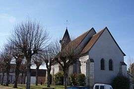
The church in Marcilly-en-Gault | |
 Marcilly-en-Gault | |
|
Location within Centre-Val de Loire region  Marcilly-en-Gault | |
| Coordinates: 47°27′57″N 1°52′28″E / 47.4658°N 1.8744°ECoordinates: 47°27′57″N 1°52′28″E / 47.4658°N 1.8744°E | |
| Country | France |
| Region | Centre-Val de Loire |
| Department | Loir-et-Cher |
| Arrondissement | Romorantin-Lanthenay |
| Canton | Salbris |
| Intercommunality | Communauté de communes La Sologne des rivières |
| Government | |
| • Mayor | Agnès Thibault |
| Area1 | 50.31 km2 (19.42 sq mi) |
| Population (1999)2 | 755 |
| • Density | 15/km2 (39/sq mi) |
| Time zone | CET (UTC+1) |
| • Summer (DST) | CEST (UTC+2) |
| INSEE/Postal code | 41125 / 41210 |
| Elevation |
94–129 m (308–423 ft) (avg. 127 m or 417 ft) |
|
1 French Land Register data, which excludes lakes, ponds, glaciers > 1 km² (0.386 sq mi or 247 acres) and river estuaries. 2 Population without double counting: residents of multiple communes (e.g., students and military personnel) only counted once. | |
Marcilly-en-Gault is a commune in the Loir-et-Cher department of central France.
See also
| Wikimedia Commons has media related to Marcilly-en-Gault. |
This article is issued from Wikipedia - version of the 2/18/2016. The text is available under the Creative Commons Attribution/Share Alike but additional terms may apply for the media files.