Muides-sur-Loire
| Muides-sur-Loire | ||
|---|---|---|
|
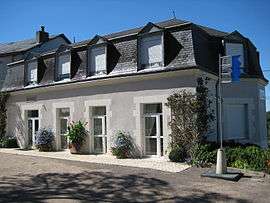
The town hall in Muides | ||
| ||
 Muides-sur-Loire | ||
|
Location within Centre-Val de Loire region  Muides-sur-Loire | ||
| Coordinates: 47°40′11″N 1°31′44″E / 47.6697°N 1.5289°ECoordinates: 47°40′11″N 1°31′44″E / 47.6697°N 1.5289°E | ||
| Country | France | |
| Region | Centre-Val de Loire | |
| Department | Loir-et-Cher | |
| Arrondissement | Blois | |
| Canton | Bracieux | |
| Intercommunality | Communauté de communes de la Beauce ligérienne | |
| Government | ||
| • Mayor | Bernard Clément | |
| Area1 | 9.15 km2 (3.53 sq mi) | |
| Population (1999)2 | 1,157 | |
| • Density | 130/km2 (330/sq mi) | |
| Time zone | CET (UTC+1) | |
| • Summer (DST) | CEST (UTC+2) | |
| INSEE/Postal code | 41155 / 41500 | |
| Elevation |
72–104 m (236–341 ft) (avg. 85 m or 279 ft) | |
|
1 French Land Register data, which excludes lakes, ponds, glaciers > 1 km² (0.386 sq mi or 247 acres) and river estuaries. 2 Population without double counting: residents of multiple communes (e.g., students and military personnel) only counted once. | ||
.svg.png)
Muides-sur-Loire is a commune in the Loir-et-Cher department of central France.
See also
| Wikimedia Commons has media related to Muides-sur-Loire. |
This article is issued from Wikipedia - version of the 3/1/2015. The text is available under the Creative Commons Attribution/Share Alike but additional terms may apply for the media files.