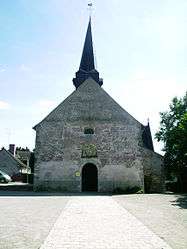
Crouy-sur-Cosson
| Crouy-sur-Cosson | |
|---|---|
 | |
 Crouy-sur-Cosson | |
|
Location within Centre-Val de Loire region  Crouy-sur-Cosson | |
| Coordinates: 47°39′05″N 1°36′27″E / 47.6514°N 1.6075°ECoordinates: 47°39′05″N 1°36′27″E / 47.6514°N 1.6075°E | |
| Country | France |
| Region | Centre-Val de Loire |
| Department | Loir-et-Cher |
| Arrondissement | Blois |
| Canton | Bracieux |
| Intercommunality | Pays de Chambord |
| Government | |
| • Mayor (2014–2020) | Claudette Sorin |
| Area1 | 28.37 km2 (10.95 sq mi) |
| Population (2013)2 | 502 |
| • Density | 18/km2 (46/sq mi) |
| Time zone | CET (UTC+1) |
| • Summer (DST) | CEST (UTC+2) |
| INSEE/Postal code | 41071 / 41220 |
| Elevation |
77–111 m (253–364 ft) (avg. 85 m or 279 ft) |
|
1 French Land Register data, which excludes lakes, ponds, glaciers > 1 km² (0.386 sq mi or 247 acres) and river estuaries. 2 Population without double counting: residents of multiple communes (e.g., students and military personnel) only counted once. | |
Crouy-sur-Cosson is a commune in the Loir-et-Cher department of central France.
Population
| Historical population | ||
|---|---|---|
| Year | Pop. | ±% |
| 1793 | 450 | — |
| 1806 | 451 | +0.2% |
| 1821 | 442 | −2.0% |
| 1831 | 448 | +1.4% |
| 1841 | 421 | −6.0% |
| 1851 | 417 | −1.0% |
| 1861 | 478 | +14.6% |
| 1872 | 484 | +1.3% |
| 1881 | 534 | +10.3% |
| 1891 | 532 | −0.4% |
| 1901 | 511 | −3.9% |
| 1911 | 505 | −1.2% |
| 1921 | 463 | −8.3% |
| 1931 | 442 | −4.5% |
| 1946 | 492 | +11.3% |
| 1954 | 487 | −1.0% |
| 1962 | 415 | −14.8% |
| 1968 | 438 | +5.5% |
| 1975 | 404 | −7.8% |
| 1982 | 461 | +14.1% |
| 1990 | 471 | +2.2% |
| 1999 | 472 | +0.2% |
| 2008 | 506 | +7.2% |
| 2013 | 502 | −0.8% |
See also
References
| Wikimedia Commons has media related to Crouy-sur-Cosson. |
This article is issued from Wikipedia - version of the 11/15/2016. The text is available under the Creative Commons Attribution/Share Alike but additional terms may apply for the media files.