La Ferté-Imbault
| La Ferté-Imbault | ||
|---|---|---|
|
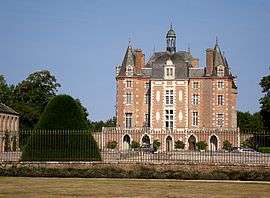
Chateau | ||
| ||
 La Ferté-Imbault | ||
|
Location within Centre-Val de Loire region  La Ferté-Imbault | ||
| Coordinates: 47°23′12″N 1°57′23″E / 47.3867°N 1.9564°ECoordinates: 47°23′12″N 1°57′23″E / 47.3867°N 1.9564°E | ||
| Country | France | |
| Region | Centre-Val de Loire | |
| Department | Loir-et-Cher | |
| Arrondissement | Romorantin-Lanthenay | |
| Canton | Salbris | |
| Intercommunality | Sologne des rivières | |
| Government | ||
| • Mayor (2014–2020) | Isabelle Gasselin | |
| Area1 | 50.02 km2 (19.31 sq mi) | |
| Population (2013)2 | 985 | |
| • Density | 20/km2 (51/sq mi) | |
| Time zone | CET (UTC+1) | |
| • Summer (DST) | CEST (UTC+2) | |
| INSEE/Postal code | 41084 / 41300 | |
| Elevation | 94–126 m (308–413 ft) | |
|
1 French Land Register data, which excludes lakes, ponds, glaciers > 1 km² (0.386 sq mi or 247 acres) and river estuaries. 2 Population without double counting: residents of multiple communes (e.g., students and military personnel) only counted once. | ||
.svg.png)
La Ferté-Imbault is a commune in the Loir-et-Cher department of central France.
Geography
The Rère forms part of the commune's southern border.
Population
| Historical population | ||
|---|---|---|
| Year | Pop. | ±% |
| 1861 | 877 | — |
| 1872 | 943 | +7.5% |
| 1881 | 991 | +5.1% |
| 1891 | 1,019 | +2.8% |
| 1901 | 1,036 | +1.7% |
| 1911 | 1,052 | +1.5% |
| 1921 | 1,053 | +0.1% |
| 1931 | 1,015 | −3.6% |
| 1946 | 1,247 | +22.9% |
| 1954 | 1,171 | −6.1% |
| 1962 | 1,176 | +0.4% |
| 1968 | 1,088 | −7.5% |
| 1975 | 1,123 | +3.2% |
| 1982 | 1,104 | −1.7% |
| 1990 | 1,047 | −5.2% |
| 1999 | 1,035 | −1.1% |
| 2008 | 966 | −6.7% |
| 2013 | 985 | +2.0% |
Veteran cycles rally
The annual rally of the International Veteran Cycle Association was held in La Ferté-Imbault from 1 to 5 June 2011.
See also
References
| Wikimedia Commons has media related to La Ferté-Imbault. |
This article is issued from Wikipedia - version of the 11/24/2016. The text is available under the Creative Commons Attribution/Share Alike but additional terms may apply for the media files.