Chémery
| Chémery | ||
|---|---|---|
|
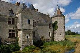
Chateau | ||
| ||
 Chémery | ||
|
Location within Centre-Val de Loire region  Chémery | ||
| Coordinates: 47°20′45″N 1°28′44″E / 47.3458°N 1.4789°ECoordinates: 47°20′45″N 1°28′44″E / 47.3458°N 1.4789°E | ||
| Country | France | |
| Region | Centre-Val de Loire | |
| Department | Loir-et-Cher | |
| Arrondissement | Romorantin-Lanthenay | |
| Canton | Saint-Aignan | |
| Intercommunality | Controis | |
| Government | ||
| • Mayor (2014–2020) | Françoise Charles | |
| Area1 | 34.16 km2 (13.19 sq mi) | |
| Population (2013)2 | 979 | |
| • Density | 29/km2 (74/sq mi) | |
| Time zone | CET (UTC+1) | |
| • Summer (DST) | CEST (UTC+2) | |
| INSEE/Postal code | 41049 / 41700 | |
| Elevation |
84–136 m (276–446 ft) (avg. 90 m or 300 ft) | |
|
1 French Land Register data, which excludes lakes, ponds, glaciers > 1 km² (0.386 sq mi or 247 acres) and river estuaries. 2 Population without double counting: residents of multiple communes (e.g., students and military personnel) only counted once. | ||

Chémery is a commune in the Loir-et-Cher department in central France.
Population
| Historical population | ||
|---|---|---|
| Year | Pop. | ±% |
| 1793 | 603 | — |
| 1806 | 619 | +2.7% |
| 1821 | 774 | +25.0% |
| 1831 | 742 | −4.1% |
| 1841 | 789 | +6.3% |
| 1851 | 933 | +18.3% |
| 1861 | 1,057 | +13.3% |
| 1872 | 1,037 | −1.9% |
| 1881 | 1,134 | +9.4% |
| 1891 | 1,331 | +17.4% |
| 1901 | 1,338 | +0.5% |
| 1911 | 1,279 | −4.4% |
| 1921 | 1,238 | −3.2% |
| 1931 | 1,161 | −6.2% |
| 1946 | 1,063 | −8.4% |
| 1954 | 1,031 | −3.0% |
| 1962 | 1,073 | +4.1% |
| 1968 | 1,047 | −2.4% |
| 1975 | 1,011 | −3.4% |
| 1982 | 921 | −8.9% |
| 1990 | 875 | −5.0% |
| 1999 | 849 | −3.0% |
| 2008 | 924 | +8.8% |
| 2013 | 979 | +6.0% |
See also
References
| Wikimedia Commons has media related to Chémery. |
This article is issued from Wikipedia - version of the 11/12/2016. The text is available under the Creative Commons Attribution/Share Alike but additional terms may apply for the media files.