Marchenoir
| Marchenoir | ||
|---|---|---|
|
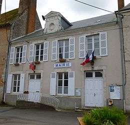
The town hall in Marchenoir | ||
| ||
 Marchenoir | ||
|
Location within Centre-Val de Loire region  Marchenoir | ||
| Coordinates: 47°49′27″N 1°23′44″E / 47.8242°N 1.3956°ECoordinates: 47°49′27″N 1°23′44″E / 47.8242°N 1.3956°E | ||
| Country | France | |
| Region | Centre-Val de Loire | |
| Department | Loir-et-Cher | |
| Arrondissement | Blois | |
| Canton |
Marchenoir (chef-lieu) | |
| Intercommunality | Communauté de communes de Beauce et Forêt | |
| Government | ||
| • Mayor | Marc Fesneau | |
| Area1 | 9.42 km2 (3.64 sq mi) | |
| Population (1999)2 | 632 | |
| • Density | 67/km2 (170/sq mi) | |
| Time zone | CET (UTC+1) | |
| • Summer (DST) | CEST (UTC+2) | |
| INSEE/Postal code | 41123 / 41370 | |
| Elevation |
124–151 m (407–495 ft) (avg. 135 m or 443 ft) | |
|
1 French Land Register data, which excludes lakes, ponds, glaciers > 1 km² (0.386 sq mi or 247 acres) and river estuaries. 2 Population without double counting: residents of multiple communes (e.g., students and military personnel) only counted once. | ||
.svg.png)
Marchenoir is a commune in the Loir-et-Cher department of central France. The nearby Forest of Marchenoir was the site of L'Aumône Abbey, a Cistercian daughter house of Cîteaux Abbey. The Earl of Buckingham stayed at the Abbey in 1380 whilst his army was quartered in the Forest.[1]
History
In 1650 Claude Pajon was appointed to be pastor to the Reformed Church at Marchenoir.[2]
- The husband and wife comedians Raymond Bussières and Annette Poivre are buried in Marchenoir cemetery..
See also
| Wikimedia Commons has media related to Marchenoir. |
References
- ↑ John Froissart, John (1395). Froissart's Chronicles Book II. Manuscript. Retrieved 1 August 2015.
- ↑ Gootjes, Albert (2013). Claude Pajon (1626-1685) and the Academy of Saumur: The First Controversy over Grace. Brill.
This article is issued from Wikipedia - version of the 8/1/2015. The text is available under the Creative Commons Attribution/Share Alike but additional terms may apply for the media files.