L'Épine-aux-Bois
| L'Épine-aux-Bois | |
|---|---|
 L'Épine-aux-Bois | |
|
Location within Hauts-de-France region  L'Épine-aux-Bois | |
| Coordinates: 48°53′10″N 3°26′58″E / 48.8861°N 3.4494°ECoordinates: 48°53′10″N 3°26′58″E / 48.8861°N 3.4494°E | |
| Country | France |
| Region | Hauts-de-France |
| Department | Aisne |
| Arrondissement | Château-Thierry |
| Canton | Charly-sur-Marne |
| Intercommunality | Charly sur Marne |
| Government | |
| • Mayor (2008–2014) | Michel Feti |
| Area1 | 12.37 km2 (4.78 sq mi) |
| Population (2008)2 | 260 |
| • Density | 21/km2 (54/sq mi) |
| Time zone | CET (UTC+1) |
| • Summer (DST) | CEST (UTC+2) |
| INSEE/Postal code | 02281 / 02540 |
| Elevation |
149–221 m (489–725 ft) (avg. 190 m or 620 ft) |
|
1 French Land Register data, which excludes lakes, ponds, glaciers > 1 km² (0.386 sq mi or 247 acres) and river estuaries. 2 Population without double counting: residents of multiple communes (e.g., students and military personnel) only counted once. | |
L'Épine-aux-Bois is a commune in the Aisne department in Hauts-de-France in northern France.
Population
| Historical population | ||
|---|---|---|
| Year | Pop. | ±% |
| 1962 | 205 | — |
| 1968 | 179 | −12.7% |
| 1975 | 166 | −7.3% |
| 1982 | 152 | −8.4% |
| 1990 | 232 | +52.6% |
| 1999 | 231 | −0.4% |
| 2008 | 260 | +12.6% |
See also
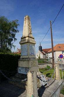
War memorial and church.
References
| Wikimedia Commons has media related to L'Épine-aux-Bois. |
This article is issued from Wikipedia - version of the 11/8/2016. The text is available under the Creative Commons Attribution/Share Alike but additional terms may apply for the media files.