Jussy-le-Chaudrier
| Jussy-le-Chaudrier | |
|---|---|
|
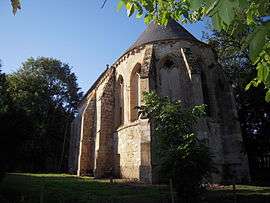
The Commandry of Jussy-le-Chaudrier, a Templar chapel | |
 Jussy-le-Chaudrier | |
|
Location within Centre-Val de Loire region  Jussy-le-Chaudrier | |
| Coordinates: 47°07′42″N 2°56′06″E / 47.1283°N 2.935°ECoordinates: 47°07′42″N 2°56′06″E / 47.1283°N 2.935°E | |
| Country | France |
| Region | Centre-Val de Loire |
| Department | Cher |
| Arrondissement | Bourges |
| Canton | Sancergues |
| Government | |
| • Mayor (2008–2014) | Jean-François Pasque |
| Area1 | 25.73 km2 (9.93 sq mi) |
| Population (2008)2 | 617 |
| • Density | 24/km2 (62/sq mi) |
| Time zone | CET (UTC+1) |
| • Summer (DST) | CEST (UTC+2) |
| INSEE/Postal code | 18120 / 18140 |
| Elevation |
165–209 m (541–686 ft) (avg. 191 m or 627 ft) |
|
1 French Land Register data, which excludes lakes, ponds, glaciers > 1 km² (0.386 sq mi or 247 acres) and river estuaries. 2 Population without double counting: residents of multiple communes (e.g., students and military personnel) only counted once. | |
Jussy-le-Chaudrier is a commune in the Cher department in the Centre region of France.
Geography
An area of forestry and farming, comprising the village and several hamlets situated in the valley of the river Vauvise, some 23 miles (37 km) east of Bourges, at the junction of the D53, D25 and the D920 roads. The river forms part of the commune's western and northern borders.
Population
| Historical population | ||
|---|---|---|
| Year | Pop. | ±% |
| 1962 | 593 | — |
| 1968 | 645 | +8.8% |
| 1975 | 565 | −12.4% |
| 1982 | 545 | −3.5% |
| 1990 | 515 | −5.5% |
| 1999 | 526 | +2.1% |
| 2008 | 617 | +17.3% |
Sights
- The church of St. Julien, dating from the sixteenth century.
- A watermill at Bion.
- Bordes chapel and tower, all that remains of a thirteenth-century commandery temple.
See also
References
External links
| Wikimedia Commons has media related to Jussy-le-Chaudrier. |
This article is issued from Wikipedia - version of the 2/27/2015. The text is available under the Creative Commons Attribution/Share Alike but additional terms may apply for the media files.