Nohant-en-Graçay
| Nohant-en-Graçay | |
|---|---|
|
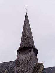
The steeple of the church of Saint-Martin, in Nohant-en-Graçay | |
 Nohant-en-Graçay | |
|
Location within Centre-Val de Loire region  Nohant-en-Graçay | |
| Coordinates: 47°08′15″N 1°53′41″E / 47.1375°N 1.8947°ECoordinates: 47°08′15″N 1°53′41″E / 47.1375°N 1.8947°E | |
| Country | France |
| Region | Centre-Val de Loire |
| Department | Cher |
| Arrondissement | Vierzon |
| Canton | Graçay |
| Intercommunality | Vallées vertes du Cher Ouest |
| Government | |
| • Mayor (2008–2014) | Serge Perrochon |
| Area1 | 23.78 km2 (9.18 sq mi) |
| Population (2008)2 | 317 |
| • Density | 13/km2 (35/sq mi) |
| Time zone | CET (UTC+1) |
| • Summer (DST) | CEST (UTC+2) |
| INSEE/Postal code | 18167 / 18310 |
| Elevation | 112–167 m (367–548 ft) |
|
1 French Land Register data, which excludes lakes, ponds, glaciers > 1 km² (0.386 sq mi or 247 acres) and river estuaries. 2 Population without double counting: residents of multiple communes (e.g., students and military personnel) only counted once. | |
Nohant-en-Graçay is a commune in the Cher department in the Centre region of France.
Geography
A farming area comprising a small village and two hamlets situated some 12 miles (19 km) southwest of Vierzon at the junction of the D68, D163 and D164 roads. The A20 runs through the commune.
Population
| Historical population | ||
|---|---|---|
| Year | Pop. | ±% |
| 1962 | 369 | — |
| 1968 | 398 | +7.9% |
| 1975 | 370 | −7.0% |
| 1982 | 318 | −14.1% |
| 1990 | 296 | −6.9% |
| 1999 | 306 | +3.4% |
| 2008 | 317 | +3.6% |
Sights
- The church, dating from the twelfth century.
- The house of Zulma Carraud, writer and friend of Balzac, next to the church.
See also
References
External links
| Wikimedia Commons has media related to Nohant-en-Graçay. |
- Nohant-en-Graçay on the Quid website (French)
This article is issued from Wikipedia - version of the 7/21/2016. The text is available under the Creative Commons Attribution/Share Alike but additional terms may apply for the media files.