Saint-Martin-des-Champs, Cher
| Saint-Martin-des-Champs | |
|---|---|
|
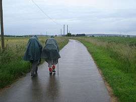
Pilgrims on the Way of St. James | |
 Saint-Martin-des-Champs | |
|
Location within Centre-Val de Loire region  Saint-Martin-des-Champs | |
| Coordinates: 47°09′30″N 2°55′24″E / 47.1583°N 2.9233°ECoordinates: 47°09′30″N 2°55′24″E / 47.1583°N 2.9233°E | |
| Country | France |
| Region | Centre-Val de Loire |
| Department | Cher |
| Arrondissement | Bourges |
| Canton | Sancergues |
| Government | |
| • Mayor (2008–2014) | André Delavault |
| Area1 | 18.96 km2 (7.32 sq mi) |
| Population (2008)2 | 345 |
| • Density | 18/km2 (47/sq mi) |
| Time zone | CET (UTC+1) |
| • Summer (DST) | CEST (UTC+2) |
| INSEE/Postal code | 18224 / 18140 |
| Elevation |
159–188 m (522–617 ft) (avg. 174 m or 571 ft) |
|
1 French Land Register data, which excludes lakes, ponds, glaciers > 1 km² (0.386 sq mi or 247 acres) and river estuaries. 2 Population without double counting: residents of multiple communes (e.g., students and military personnel) only counted once. | |
Saint-Martin-des-Champs is a commune in the Cher department in central France.
Geography
The village lies on the right bank of the Vauvise, which forms most of the commune's western border.
Population
| Historical population | ||
|---|---|---|
| Year | Pop. | ±% |
| 1962 | 418 | — |
| 1968 | 445 | +6.5% |
| 1975 | 391 | −12.1% |
| 1982 | 356 | −9.0% |
| 1990 | 335 | −5.9% |
| 1999 | 331 | −1.2% |
| 2008 | 345 | +4.2% |
See also
References
| Wikimedia Commons has media related to Saint-Martin-des-Champs (Cher). |
This article is issued from Wikipedia - version of the 3/18/2013. The text is available under the Creative Commons Attribution/Share Alike but additional terms may apply for the media files.