Saint-Laurent, Cher
| Saint-Laurent | ||
|---|---|---|
|
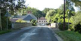
The road into Saint-Laurent | ||
| ||
 Saint-Laurent | ||
|
Location within Centre-Val de Loire region  Saint-Laurent | ||
| Coordinates: 47°13′33″N 2°12′10″E / 47.2258°N 2.2028°ECoordinates: 47°13′33″N 2°12′10″E / 47.2258°N 2.2028°E | ||
| Country | France | |
| Region | Centre-Val de Loire | |
| Department | Cher | |
| Arrondissement | Vierzon | |
| Canton | Vierzon 2 | |
| Intercommunality | Villages de la Forêt | |
| Government | ||
| • Mayor (2008–2014) | Denys Godard | |
| Area1 | 38.72 km2 (14.95 sq mi) | |
| Population (2008)2 | 398 | |
| • Density | 10/km2 (27/sq mi) | |
| Time zone | CET (UTC+1) | |
| • Summer (DST) | CEST (UTC+2) | |
| INSEE/Postal code | 18219 / 18330 | |
| Elevation |
109–188 m (358–617 ft) (avg. 115 m or 377 ft) | |
|
1 French Land Register data, which excludes lakes, ponds, glaciers > 1 km² (0.386 sq mi or 247 acres) and river estuaries. 2 Population without double counting: residents of multiple communes (e.g., students and military personnel) only counted once. | ||
.svg.png)
Saint-Laurent is a commune in the Cher department in central France.
Population
| Historical population | ||
|---|---|---|
| Year | Pop. | ±% |
| 1962 | 202 | — |
| 1968 | 231 | +14.4% |
| 1975 | 210 | −9.1% |
| 1982 | 253 | +20.5% |
| 1990 | 354 | +39.9% |
| 1999 | 352 | −0.6% |
| 2008 | 398 | +13.1% |
See also
References
| Wikimedia Commons has media related to Saint-Laurent (Cher). |
This article is issued from Wikipedia - version of the 2/28/2015. The text is available under the Creative Commons Attribution/Share Alike but additional terms may apply for the media files.