Limeux, Cher
| Limeux | |
|---|---|
|
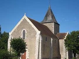
The church in Limeux | |
 Limeux | |
|
Location within Centre-Val de Loire region  Limeux | |
| Coordinates: 47°04′32″N 2°06′34″E / 47.0756°N 2.1094°ECoordinates: 47°04′32″N 2°06′34″E / 47.0756°N 2.1094°E | |
| Country | France |
| Region | Centre-Val de Loire |
| Department | Cher |
| Arrondissement | Vierzon |
| Canton | Lury-sur-Arnon |
| Intercommunality | Vals de Cher et d'Arnon |
| Government | |
| • Mayor (2008–2014) | Monique Convergne |
| Area1 | 13.17 km2 (5.08 sq mi) |
| Population (2008)2 | 149 |
| • Density | 11/km2 (29/sq mi) |
| Time zone | CET (UTC+1) |
| • Summer (DST) | CEST (UTC+2) |
| INSEE/Postal code | 18128 / 18120 |
| Elevation |
127–149 m (417–489 ft) (avg. 140 m or 460 ft) |
|
1 French Land Register data, which excludes lakes, ponds, glaciers > 1 km² (0.386 sq mi or 247 acres) and river estuaries. 2 Population without double counting: residents of multiple communes (e.g., students and military personnel) only counted once. | |
Limeux is a commune in the Cher department in the Centre region of France.
Geography
A farming area comprising the village and a couple of hamlets, situated between the valleys of the rivers Cher and Arnon some 12 miles (19 km) south of Vierzon at the junction of the D23 and the D123 roads.
Population
| Historical population | ||
|---|---|---|
| Year | Pop. | ±% |
| 1962 | 157 | — |
| 1968 | 163 | +3.8% |
| 1975 | 144 | −11.7% |
| 1982 | 133 | −7.6% |
| 1990 | 158 | +18.8% |
| 1999 | 145 | −8.2% |
| 2008 | 149 | +2.8% |
Sights
- The church of St. Martin, dating from the eleventh century.
- The castle of Saragosse, built in the fourteenth century.
- The thirteenth-century chapel of the old priory of Saint-Laurent de Manzay.
See also
References
External links
| Wikimedia Commons has media related to Limeux, Cher. |
- Limeux on the Quid website (French)
This article is issued from Wikipedia - version of the 2/27/2015. The text is available under the Creative Commons Attribution/Share Alike but additional terms may apply for the media files.