Cuffy, Cher
| Cuffy | |
|---|---|
|
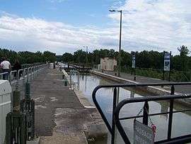
The Guétin Canal aqueduct | |
 Cuffy | |
|
Location within Centre-Val de Loire region  Cuffy | |
| Coordinates: 46°57′42″N 3°03′12″E / 46.9617°N 3.0533°ECoordinates: 46°57′42″N 3°03′12″E / 46.9617°N 3.0533°E | |
| Country | France |
| Region | Centre-Val de Loire |
| Department | Cher |
| Arrondissement | Saint-Amand-Montrond |
| Canton | La Guerche-sur-l'Aubois |
| Government | |
| • Mayor (2008–2014) | Olivier Hurabielle |
| Area1 | 34.57 km2 (13.35 sq mi) |
| Population (2008)2 | 1,115 |
| • Density | 32/km2 (84/sq mi) |
| Time zone | CET (UTC+1) |
| • Summer (DST) | CEST (UTC+2) |
| INSEE/Postal code | 18082 / 18150 |
| Elevation | 166–210 m (545–689 ft) |
|
1 French Land Register data, which excludes lakes, ponds, glaciers > 1 km² (0.386 sq mi or 247 acres) and river estuaries. 2 Population without double counting: residents of multiple communes (e.g., students and military personnel) only counted once. | |
Cuffy is a commune in the Cher department in the Centre region of France.
Geography
An area of farming and forestry comprising the village and several hamlets situated by the banks of the Loire River and Lateral Canal, the river Allier and the small river Canche, some 33 miles (53 km) east of Bourges at the junction of the D45 with the D50e, D178 and D976 roads.
Population
| Historical population | ||
|---|---|---|
| Year | Pop. | ±% |
| 1962 | 804 | — |
| 1968 | 835 | +3.9% |
| 1975 | 798 | −4.4% |
| 1982 | 871 | +9.1% |
| 1990 | 968 | +11.1% |
| 1999 | 996 | +2.9% |
| 2008 | 1,115 | +11.9% |
Sights
- The church of St. Maurice, dating from the twelfth century.
- The ruins of a fourteenth-century motte and bailey castle.
- The Chateau du Vouilly.
- The 1,343 metres (4,406 ft) aqueduct with 18 arches.
See also
References
External links
| Wikimedia Commons has media related to Cuffy. |
- Cuffy on the Quid website (French)
This article is issued from Wikipedia - version of the 2/27/2015. The text is available under the Creative Commons Attribution/Share Alike but additional terms may apply for the media files.