Mareuil-sur-Arnon
| Mareuil-sur-Arnon | |
|---|---|
|
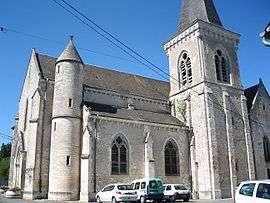
The church of Our Lady of the Assumption, in Mareuil | |
 Mareuil-sur-Arnon | |
|
Location within Centre-Val de Loire region  Mareuil-sur-Arnon | |
| Coordinates: 46°52′55″N 2°09′36″E / 46.8819°N 2.16°ECoordinates: 46°52′55″N 2°09′36″E / 46.8819°N 2.16°E | |
| Country | France |
| Region | Centre-Val de Loire |
| Department | Cher |
| Arrondissement | Bourges |
| Canton | Chârost |
| Intercommunality | Pays d’Issoudun |
| Government | |
| • Mayor (2008–2014) | Jean-Pierre Pineau |
| Area1 | 25.89 km2 (10.00 sq mi) |
| Population (2008)2 | 5,579 |
| • Density | 220/km2 (560/sq mi) |
| Time zone | CET (UTC+1) |
| • Summer (DST) | CEST (UTC+2) |
| INSEE/Postal code | 18137 / 18290 |
| Elevation |
132–172 m (433–564 ft) (avg. 155 m or 509 ft) |
|
1 French Land Register data, which excludes lakes, ponds, glaciers > 1 km² (0.386 sq mi or 247 acres) and river estuaries. 2 Population without double counting: residents of multiple communes (e.g., students and military personnel) only counted once. | |
Mareuil-sur-Arnon is a commune in the Cher department in the Centre region of France.
Geography
A forestry and farming area comprising the village and several hamlets situated by the banks of the river Arnon, some 18 miles (29 km) southwest of Bourges, at the junction of the D18, D14 and the D87 roads. The commune shares its north-western border with the departement of Indre.
Population
| Historical population | ||
|---|---|---|
| Year | Pop. | ±% |
| 1962 | 869 | — |
| 1968 | 822 | −5.4% |
| 1975 | 715 | −13.0% |
| 1982 | 659 | −7.8% |
| 1990 | 611 | −7.3% |
| 1999 | 591 | −3.3% |
| 2008 | 579 | −2.0% |
Sights
- The church of St. Pierre, rebuilt in the nineteenth century.
- A watermill.
- The ruined towers of a feudal castle.
See also
References
External links
| Wikimedia Commons has media related to Mareuil-sur-Arnon. |
This article is issued from Wikipedia - version of the 7/5/2015. The text is available under the Creative Commons Attribution/Share Alike but additional terms may apply for the media files.