Les Aix-d'Angillon
| Les Aix-d'Angillon | ||
|---|---|---|
|
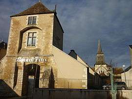
Collegiate Church of St-Germain and another building, in Les Aix-d'Angillon | ||
| ||
 Les Aix-d'Angillon | ||
|
Location within Centre-Val de Loire region  Les Aix-d'Angillon | ||
| Coordinates: 47°11′56″N 2°34′21″E / 47.1989°N 2.5725°ECoordinates: 47°11′56″N 2°34′21″E / 47.1989°N 2.5725°E | ||
| Country | France | |
| Region | Centre-Val de Loire | |
| Department | Cher | |
| Arrondissement | Bourges | |
| Canton | Les Aix-d'Angillon | |
| Intercommunality | Terroirs d'Angillon | |
| Government | ||
| • Mayor (2008–2014) | Claude Leloup | |
| Area1 | 14.68 km2 (5.67 sq mi) | |
| Population (2008)2 | 1,923 | |
| • Density | 130/km2 (340/sq mi) | |
| Time zone | CET (UTC+1) | |
| • Summer (DST) | CEST (UTC+2) | |
| INSEE/Postal code | 18003 / 18220 | |
| Elevation |
163–211 m (535–692 ft) (avg. 82 m or 269 ft) | |
|
1 French Land Register data, which excludes lakes, ponds, glaciers > 1 km² (0.386 sq mi or 247 acres) and river estuaries. 2 Population without double counting: residents of multiple communes (e.g., students and military personnel) only counted once. | ||

Les Aix-d’Angillon is a commune in the Cher department in the Centre region of France.
Geography
A small farming town, with a little associated light industry, situated some 11 miles (18 km) northeast of Bourges, at the junction of the D955, D25, D12 and the D46 roads. The small rivers Colin and Quatier flow southward through the commune.
Population
| Historical population | ||
|---|---|---|
| Year | Pop. | ±% |
| 1962 | 1,118 | — |
| 1968 | 1,246 | +11.4% |
| 1975 | 1,945 | +56.1% |
| 1982 | 2,146 | +10.3% |
| 1990 | 2,160 | +0.7% |
| 1999 | 2,006 | −7.1% |
| 2008 | 1,923 | −4.1% |
Sights
- A sixteenth century hospice.
- The church of Notre-Dame, dating from the twelfth century.
- The church of St.Germain de Valentigny.
- Traces of the feudal castle.
See also
References
External links
| Wikimedia Commons has media related to Les Aix-d'Angillon. |
- Official website of Les Aix-d'Angillon (French)
- Les Aix-d’Angillon on the Quid website (French)
This article is issued from Wikipedia - version of the 7/20/2016. The text is available under the Creative Commons Attribution/Share Alike but additional terms may apply for the media files.