Aumelas
| Aumelas | ||
|---|---|---|
|
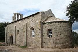
Chapel of Cardonnet | ||
| ||
 Aumelas | ||
|
Location within Occitanie region  Aumelas | ||
| Coordinates: 43°36′14″N 3°35′57″E / 43.6039°N 3.5992°ECoordinates: 43°36′14″N 3°35′57″E / 43.6039°N 3.5992°E | ||
| Country | France | |
| Region | Occitanie | |
| Department | Hérault | |
| Arrondissement | Lodève | |
| Canton | Gignac | |
| Intercommunality | Vallée de l'Hérault | |
| Government | ||
| • Mayor (2008–2014) | Michel Saintpierre | |
| Area1 | 58.26 km2 (22.49 sq mi) | |
| Population (2008)2 | 469 | |
| • Density | 8.1/km2 (21/sq mi) | |
| Time zone | CET (UTC+1) | |
| • Summer (DST) | CEST (UTC+2) | |
| INSEE/Postal code | 34016 / 34230 | |
| Elevation |
64–341 m (210–1,119 ft) (avg. 295 m or 968 ft) | |
|
1 French Land Register data, which excludes lakes, ponds, glaciers > 1 km² (0.386 sq mi or 247 acres) and river estuaries. 2 Population without double counting: residents of multiple communes (e.g., students and military personnel) only counted once. | ||
.svg.png)
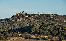
The castle from West.
Aumelas is a commune in the Hérault department in southern France.
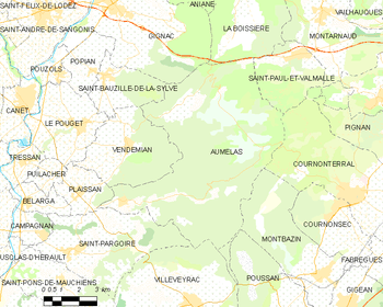
Map
Population
| Historical population | ||
|---|---|---|
| Year | Pop. | ±% |
| 1962 | 210 | — |
| 1968 | 225 | +7.1% |
| 1975 | 191 | −15.1% |
| 1982 | 245 | +28.3% |
| 1990 | 332 | +35.5% |
| 1999 | 378 | +13.9% |
| 2008 | 469 | +24.1% |
See also
References
| Wikimedia Commons has media related to Aumelas. |
This article is issued from Wikipedia - version of the 2/11/2016. The text is available under the Creative Commons Attribution/Share Alike but additional terms may apply for the media files.