Gabian
Gabian is also the Piemontese name for Gabiano, Italy.
| Gabian | ||
|---|---|---|
|
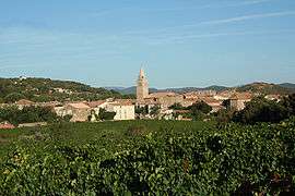
View of Gabian | ||
| ||
 Gabian | ||
|
Location within Occitanie region  Gabian | ||
| Coordinates: 43°30′52″N 3°16′25″E / 43.5144°N 3.2736°ECoordinates: 43°30′52″N 3°16′25″E / 43.5144°N 3.2736°E | ||
| Country | France | |
| Region | Occitanie | |
| Department | Hérault | |
| Arrondissement | Béziers | |
| Canton | Roujan | |
| Intercommunality | Communauté de communes des Avant-Monts du Centre Hérault | |
| Government | ||
| • Mayor (2008–2014) | Francis Boutes | |
| Area1 | 15.96 km2 (6.16 sq mi) | |
| Population (2008)2 | 802 | |
| • Density | 50/km2 (130/sq mi) | |
| Time zone | CET (UTC+1) | |
| • Summer (DST) | CEST (UTC+2) | |
| INSEE/Postal code | 34109 / 34320 | |
| Elevation |
82–260 m (269–853 ft) (avg. 121 m or 397 ft) | |
|
1 French Land Register data, which excludes lakes, ponds, glaciers > 1 km² (0.386 sq mi or 247 acres) and river estuaries. 2 Population without double counting: residents of multiple communes (e.g., students and military personnel) only counted once. | ||
.svg.png)
Gabian is a commune in the Hérault département in Occitanie in southern France.
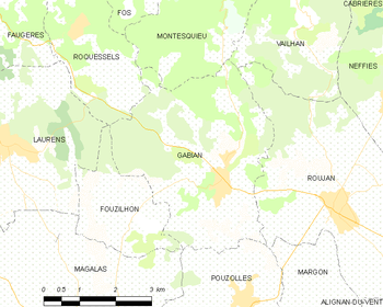
Map
Population
| Historical population | ||
|---|---|---|
| Year | Pop. | ±% |
| 1962 | 744 | — |
| 1968 | 780 | +4.8% |
| 1975 | 743 | −4.7% |
| 1982 | 640 | −13.9% |
| 1990 | 651 | +1.7% |
| 1999 | 659 | +1.2% |
| 2008 | 802 | +21.7% |
See also
References
| Wikimedia Commons has media related to Gabian. |
This article is issued from Wikipedia - version of the 11/12/2016. The text is available under the Creative Commons Attribution/Share Alike but additional terms may apply for the media files.