Claret, Hérault
| Claret | ||
|---|---|---|
|
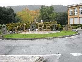
Sculpture made by a local craftsman in local quarry stone at the entrance of the village, before the bridge over the Brestalou. In the background is the Crête de Taillade. | ||
| ||
 Claret | ||
|
Location within Occitanie region  Claret | ||
| Coordinates: 43°51′46″N 3°54′20″E / 43.8628°N 3.9056°ECoordinates: 43°51′46″N 3°54′20″E / 43.8628°N 3.9056°E | ||
| Country | France | |
| Region | Occitanie | |
| Department | Hérault | |
| Arrondissement | Montpellier | |
| Canton | Claret | |
| Intercommunality | Orthus | |
| Government | ||
| • Mayor (2008–2014) | André Cot | |
| Area1 | 28.27 km2 (10.92 sq mi) | |
| Population (2008)2 | 1,364 | |
| • Density | 48/km2 (120/sq mi) | |
| Time zone | CET (UTC+1) | |
| • Summer (DST) | CEST (UTC+2) | |
| INSEE/Postal code | 34078 / 34270 | |
| Elevation |
135–410 m (443–1,345 ft) (avg. 115 m or 377 ft) | |
|
1 French Land Register data, which excludes lakes, ponds, glaciers > 1 km² (0.386 sq mi or 247 acres) and river estuaries. 2 Population without double counting: residents of multiple communes (e.g., students and military personnel) only counted once. | ||
.svg.png)
Claret is a commune in the Hérault department in southern France.
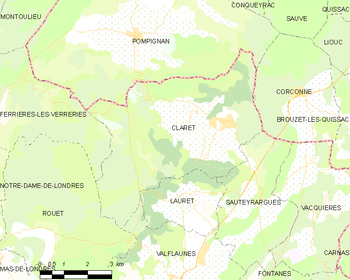
Geographic map of Claret within Hérault
Population
| Historical population | ||
|---|---|---|
| Year | Pop. | ±% |
| 1962 | 468 | — |
| 1968 | 468 | +0.0% |
| 1975 | 476 | +1.7% |
| 1982 | 526 | +10.5% |
| 1990 | 825 | +56.8% |
| 1999 | 1,069 | +29.6% |
| 2008 | 1,364 | +27.6% |
See also
References
| Wikimedia Commons has media related to Claret (Hérault). |
This article is issued from Wikipedia - version of the 9/16/2016. The text is available under the Creative Commons Attribution/Share Alike but additional terms may apply for the media files.