Le Caylar
| Le Caylar | ||
|---|---|---|
|
A general view of Le Caylar | ||
| ||
 Le Caylar | ||
|
Location within Occitanie region  Le Caylar | ||
| Coordinates: 43°51′50″N 3°19′11″E / 43.8639°N 3.3197°ECoordinates: 43°51′50″N 3°19′11″E / 43.8639°N 3.3197°E | ||
| Country | France | |
| Region | Occitanie | |
| Department | Hérault | |
| Arrondissement | Lodève | |
| Canton | Le Caylar | |
| Intercommunality | Lodévois - Larzac | |
| Government | ||
| • Mayor (2008–2014) | Jean Trinquier | |
| Area1 | 22.08 km2 (8.53 sq mi) | |
| Population (2008)2 | 437 | |
| • Density | 20/km2 (51/sq mi) | |
| Time zone | CET (UTC+1) | |
| • Summer (DST) | CEST (UTC+2) | |
| INSEE/Postal code | 34064 / 34520 | |
| Elevation |
714–826 m (2,343–2,710 ft) (avg. 752 m or 2,467 ft) | |
|
1 French Land Register data, which excludes lakes, ponds, glaciers > 1 km² (0.386 sq mi or 247 acres) and river estuaries. 2 Population without double counting: residents of multiple communes (e.g., students and military personnel) only counted once. | ||

.svg.png)
Le Caylar, also known as Le-Caylar-en-Larzac, is a commune in the Hérault department in southern France.
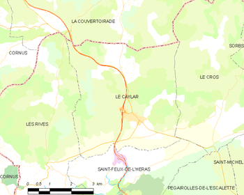
Map
Population
| Historical population | ||
|---|---|---|
| Year | Pop. | ±% |
| 1793 | 628 | — |
| 1801 | 720 | +14.6% |
| 1806 | 757 | +5.1% |
| 1821 | 809 | +6.9% |
| 1831 | 805 | −0.5% |
| 1836 | 860 | +6.8% |
| 1841 | 824 | −4.2% |
| 1846 | 830 | +0.7% |
| 1851 | 875 | +5.4% |
| 1856 | 849 | −3.0% |
| 1861 | 863 | +1.6% |
| 1866 | 841 | −2.5% |
| 1872 | 819 | −2.6% |
| 1876 | 796 | −2.8% |
| 1881 | 766 | −3.8% |
| 1886 | 714 | −6.8% |
| 1891 | 719 | +0.7% |
| 1896 | 678 | −5.7% |
| 1901 | 626 | −7.7% |
| 1906 | 596 | −4.8% |
| 1911 | 550 | −7.7% |
| 1921 | 502 | −8.7% |
| 1926 | 508 | +1.2% |
| 1931 | 504 | −0.8% |
| 1936 | 449 | −10.9% |
| 1946 | 397 | −11.6% |
| 1954 | 378 | −4.8% |
| 1962 | 318 | −15.9% |
| 1968 | 327 | +2.8% |
| 1975 | 259 | −20.8% |
| 1982 | 295 | +13.9% |
| 1990 | 339 | +14.9% |
| 1999 | 383 | +13.0% |
| 2008 | 437 | +14.1% |
See also
References
| Wikimedia Commons has media related to Le Caylar (Hérault). |
This article is issued from Wikipedia - version of the 6/24/2015. The text is available under the Creative Commons Attribution/Share Alike but additional terms may apply for the media files.