Castelnau-le-Lez
| Castelnau-le-Lez | |
|---|---|
|
Church Saint-Jean-Baptiste | |
 Castelnau-le-Lez | |
|
Location within Occitanie region  Castelnau-le-Lez | |
| Coordinates: 43°38′13″N 3°54′07″E / 43.6369°N 3.9019°ECoordinates: 43°38′13″N 3°54′07″E / 43.6369°N 3.9019°E | |
| Country | France |
| Region | Occitanie |
| Department | Hérault |
| Arrondissement | Montpellier |
| Canton | Castelnau-le-Lez |
| Intercommunality | Montpellier |
| Government | |
| • Mayor (2014–2020) | Jean-Pierre Grand (RS) |
| Area1 | 11.18 km2 (4.32 sq mi) |
| Population (2008)2 | 14,999 |
| • Density | 1,300/km2 (3,500/sq mi) |
| Time zone | CET (UTC+1) |
| • Summer (DST) | CEST (UTC+2) |
| INSEE/Postal code | 34057 / 34170 |
| Elevation |
19–93 m (62–305 ft) (avg. 60 m or 200 ft) |
|
1 French Land Register data, which excludes lakes, ponds, glaciers > 1 km² (0.386 sq mi or 247 acres) and river estuaries. 2 Population without double counting: residents of multiple communes (e.g., students and military personnel) only counted once. | |

Castelnau-le-Lez is a commune in the Hérault department in southern France. It is on the outskirts of Montpellier, around 3 km north of the centre of Montpellier.
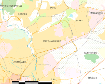
Map
Population
| Historical population | ||
|---|---|---|
| Year | Pop. | ±% |
| 1793 | 450 | — |
| 1800 | 496 | +10.2% |
| 1806 | 547 | +10.3% |
| 1821 | 696 | +27.2% |
| 1831 | 673 | −3.3% |
| 1836 | 745 | +10.7% |
| 1841 | 787 | +5.6% |
| 1846 | 794 | +0.9% |
| 1851 | 861 | +8.4% |
| 1856 | 827 | −3.9% |
| 1861 | 894 | +8.1% |
| 1866 | 1,120 | +25.3% |
| 1872 | 906 | −19.1% |
| 1876 | 884 | −2.4% |
| 1881 | 815 | −7.8% |
| 1886 | 884 | +8.5% |
| 1891 | 954 | +7.9% |
| 1896 | 1,141 | +19.6% |
| 1901 | 1,213 | +6.3% |
| 1906 | 1,202 | −0.9% |
| 1911 | 1,103 | −8.2% |
| 1921 | 1,120 | +1.5% |
| 1926 | 1,504 | +34.3% |
| 1931 | 1,959 | +30.3% |
| 1936 | 2,226 | +13.6% |
| 1946 | 2,345 | +5.3% |
| 1954 | 2,923 | +24.6% |
| 1962 | 4,979 | +70.3% |
| 1968 | 8,169 | +64.1% |
| 1975 | 9,339 | +14.3% |
| 1982 | 9,884 | +5.8% |
| 1990 | 11,043 | +11.7% |
| 1999 | 14,214 | +28.7% |
| 2008 | 14,999 | +5.5% |
See also
References
| Wikimedia Commons has media related to Castelnau-le-Lez. |
This article is issued from Wikipedia - version of the 6/21/2015. The text is available under the Creative Commons Attribution/Share Alike but additional terms may apply for the media files.