Le Pradal
| Le Pradal | ||
|---|---|---|
|
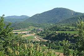
The landscape of Le Pradal | ||
| ||
 Le Pradal | ||
|
Location within Occitanie region  Le Pradal | ||
| Coordinates: 43°37′42″N 3°06′18″E / 43.6283°N 3.105°ECoordinates: 43°37′42″N 3°06′18″E / 43.6283°N 3.105°E | ||
| Country | France | |
| Region | Occitanie | |
| Department | Hérault | |
| Arrondissement | Béziers | |
| Canton | Bédarieux | |
| Intercommunality | Sources | |
| Government | ||
| • Mayor (2008–2014) | Guy Laures | |
| Area1 | 3.8 km2 (1.5 sq mi) | |
| Population (2008)2 | 265 | |
| • Density | 70/km2 (180/sq mi) | |
| Time zone | CET (UTC+1) | |
| • Summer (DST) | CEST (UTC+2) | |
| INSEE/Postal code | 34216 / 34600 | |
| Elevation |
236–662 m (774–2,172 ft) (avg. 272 m or 892 ft) | |
|
1 French Land Register data, which excludes lakes, ponds, glaciers > 1 km² (0.386 sq mi or 247 acres) and river estuaries. 2 Population without double counting: residents of multiple communes (e.g., students and military personnel) only counted once. | ||
.svg.png)
Le Pradal is a commune in the Hérault department in the Occitanie region in southern France.
Population
| Historical population | ||
|---|---|---|
| Year | Pop. | ±% |
| 1962 | 101 | — |
| 1968 | 101 | +0.0% |
| 1975 | 97 | −4.0% |
| 1982 | 136 | +40.2% |
| 1990 | 178 | +30.9% |
| 1999 | 191 | +7.3% |
| 2008 | 265 | +38.7% |
See also
References
| Wikimedia Commons has media related to Le Pradal. |
This article is issued from Wikipedia - version of the 11/12/2016. The text is available under the Creative Commons Attribution/Share Alike but additional terms may apply for the media files.