Moulès-et-Baucels
| Moulès-et-Baucels | ||
|---|---|---|
|
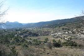
A general view of Moulès-et-Baucels | ||
| ||
 Moulès-et-Baucels | ||
|
Location within Occitanie region  Moulès-et-Baucels | ||
| Coordinates: 43°56′55″N 3°44′00″E / 43.9486°N 3.7333°ECoordinates: 43°56′55″N 3°44′00″E / 43.9486°N 3.7333°E | ||
| Country | France | |
| Region | Occitanie | |
| Department | Hérault | |
| Arrondissement | Lodève | |
| Canton | Ganges | |
| Intercommunality | Cévennes Gangeoises et Suménoises | |
| Government | ||
| • Mayor (2008–2014) | Jean-Pierre Gaubiac | |
| Area1 | 22.78 km2 (8.80 sq mi) | |
| Population (2008)2 | 803 | |
| • Density | 35/km2 (91/sq mi) | |
| Time zone | CET (UTC+1) | |
| • Summer (DST) | CEST (UTC+2) | |
| INSEE/Postal code | 34174 / 34190 | |
| Elevation |
156–727 m (512–2,385 ft) (avg. 122 m or 400 ft) | |
|
1 French Land Register data, which excludes lakes, ponds, glaciers > 1 km² (0.386 sq mi or 247 acres) and river estuaries. 2 Population without double counting: residents of multiple communes (e.g., students and military personnel) only counted once. | ||
.svg.png)
Moulès-et-Baucels is a commune in the Hérault department in the Occitanie region in southern France.
Population
| Historical population | ||
|---|---|---|
| Year | Pop. | ±% |
| 1962 | 65 | — |
| 1968 | 77 | +18.5% |
| 1975 | 128 | +66.2% |
| 1982 | 190 | +48.4% |
| 1990 | 297 | +56.3% |
| 1999 | 598 | +101.3% |
| 2008 | 803 | +34.3% |
See also
References
| Wikimedia Commons has media related to Moulès-et-Baucels. |
This article is issued from Wikipedia - version of the 11/12/2016. The text is available under the Creative Commons Attribution/Share Alike but additional terms may apply for the media files.