Castelnau-de-Guers
| Castelnau-de-Guers | ||
|---|---|---|
|
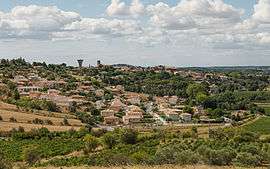
General view from Northeast | ||
| ||
 Castelnau-de-Guers | ||
|
Location within Occitanie region  Castelnau-de-Guers | ||
| Coordinates: 43°26′09″N 3°26′21″E / 43.4358°N 3.4392°ECoordinates: 43°26′09″N 3°26′21″E / 43.4358°N 3.4392°E | ||
| Country | France | |
| Region | Occitanie | |
| Department | Hérault | |
| Arrondissement | Béziers | |
| Canton | Florensac | |
| Intercommunality | Hérault Méditerranée | |
| Government | ||
| • Mayor (2014–2020) | Jean-Charles Sers | |
| Area1 | 22.51 km2 (8.69 sq mi) | |
| Population (2008)2 | 1,087 | |
| • Density | 48/km2 (130/sq mi) | |
| Time zone | CET (UTC+1) | |
| • Summer (DST) | CEST (UTC+2) | |
| INSEE/Postal code | 34056 / 34120 | |
| Elevation | 1–105 m (3.3–344.5 ft) | |
|
1 French Land Register data, which excludes lakes, ponds, glaciers > 1 km² (0.386 sq mi or 247 acres) and river estuaries. 2 Population without double counting: residents of multiple communes (e.g., students and military personnel) only counted once. | ||
.svg.png)
Castelnau-de-Guers is a commune in the Hérault department in southern France. It is the birthplace of historian Michel Christol.

Map
Population
| Historical population | ||
|---|---|---|
| Year | Pop. | ±% |
| 1962 | 831 | — |
| 1968 | 837 | +0.7% |
| 1975 | 827 | −1.2% |
| 1982 | 886 | +7.1% |
| 1990 | 876 | −1.1% |
| 1999 | 889 | +1.5% |
| 2008 | 1,087 | +22.3% |
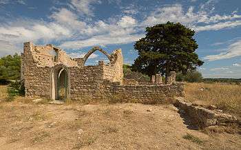
Ruins of the Hermitage Saint-Antoine
.jpg)
Vineyard and Mas du Sol
See also
References
| Wikimedia Commons has media related to Castelnau-de-Guers. |
This article is issued from Wikipedia - version of the 10/16/2016. The text is available under the Creative Commons Attribution/Share Alike but additional terms may apply for the media files.