Nissan-lez-Enserune
| Nissan-lez-Ensérune | ||
|---|---|---|
|
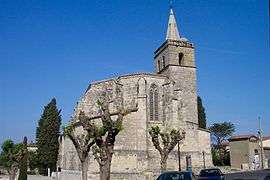
The church of Nissan-lez-Enserune | ||
| ||
 Nissan-lez-Ensérune | ||
|
Location within Occitanie region  Nissan-lez-Ensérune | ||
| Coordinates: 43°17′21″N 3°07′46″E / 43.2892°N 3.1294°ECoordinates: 43°17′21″N 3°07′46″E / 43.2892°N 3.1294°E | ||
| Country | France | |
| Region | Occitanie | |
| Department | Hérault | |
| Arrondissement | Béziers | |
| Canton | Capestang | |
| Intercommunality | Domitienne | |
| Government | ||
| • Mayor (2008–2014) | Pierre Cros | |
| Area1 | 29.74 km2 (11.48 sq mi) | |
| Population (2008)2 | 3,410 | |
| • Density | 110/km2 (300/sq mi) | |
| Time zone | CET (UTC+1) | |
| • Summer (DST) | CEST (UTC+2) | |
| INSEE/Postal code | 34183 / 34440 | |
| Elevation |
0–122 m (0–400 ft) (avg. 21 m or 69 ft) | |
|
1 French Land Register data, which excludes lakes, ponds, glaciers > 1 km² (0.386 sq mi or 247 acres) and river estuaries. 2 Population without double counting: residents of multiple communes (e.g., students and military personnel) only counted once. | ||
.svg.png)
Nissan-lez-Enserune is a commune in the Hérault department in the Occitanie region in southern France.
It is situated just south of Béziers.
Population
| Historical population | ||
|---|---|---|
| Year | Pop. | ±% |
| 1962 | 2,330 | — |
| 1968 | 2,450 | +5.2% |
| 1975 | 2,251 | −8.1% |
| 1982 | 2,519 | +11.9% |
| 1990 | 2,835 | +12.5% |
| 1999 | 2,969 | +4.7% |
| 2008 | 3,410 | +14.9% |
International relations
Nissan-lez-Enserune is twinned with
See also
References
| Wikimedia Commons has media related to Nissan-lez-Enserune. |
This article is issued from Wikipedia - version of the 11/12/2016. The text is available under the Creative Commons Attribution/Share Alike but additional terms may apply for the media files.