Saint-Brès, Hérault
| Saint-Brès | ||
|---|---|---|
|
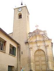
The church of Saint-Brès | ||
| ||
 Saint-Brès | ||
|
Location within Occitanie region  Saint-Brès | ||
| Coordinates: 43°40′06″N 4°01′48″E / 43.6683°N 4.03°ECoordinates: 43°40′06″N 4°01′48″E / 43.6683°N 4.03°E | ||
| Country | France | |
| Region | Occitanie | |
| Department | Hérault | |
| Arrondissement | Montpellier | |
| Canton | Castries | |
| Intercommunality | Montpellier Agglomération | |
| Government | ||
| • Mayor (2008–2010) | Christian Gesbert | |
| Area1 | 4.86 km2 (1.88 sq mi) | |
| Population (2008)2 | 2,638 | |
| • Density | 540/km2 (1,400/sq mi) | |
| Time zone | CET (UTC+1) | |
| • Summer (DST) | CEST (UTC+2) | |
| INSEE/Postal code | 34244 / 34670 | |
| Elevation |
13–41 m (43–135 ft) (avg. 23 m or 75 ft) | |
|
1 French Land Register data, which excludes lakes, ponds, glaciers > 1 km² (0.386 sq mi or 247 acres) and river estuaries. 2 Population without double counting: residents of multiple communes (e.g., students and military personnel) only counted once. | ||
.svg.png)
Saint-Brès is a commune in the Hérault department in the Occitanie region in southern France.
Population
| Historical population | ||
|---|---|---|
| Year | Pop. | ±% |
| 1962 | 438 | — |
| 1968 | 573 | +30.8% |
| 1975 | 1,094 | +90.9% |
| 1982 | 1,515 | +38.5% |
| 1990 | 1,958 | +29.2% |
| 1999 | 2,477 | +26.5% |
| 2008 | 2,638 | +6.5% |
See also
References
| Wikimedia Commons has media related to Saint-Brès (Hérault). |
This article is issued from Wikipedia - version of the 11/12/2016. The text is available under the Creative Commons Attribution/Share Alike but additional terms may apply for the media files.