Roqueredonde
| Roqueredonde | ||
|---|---|---|
|
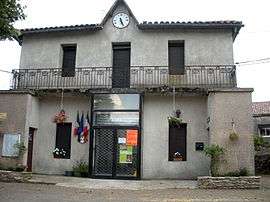
Town hall | ||
| ||
 Roqueredonde | ||
|
Location within Occitanie region  Roqueredonde | ||
| Coordinates: 43°48′05″N 3°12′46″E / 43.8014°N 3.2128°ECoordinates: 43°48′05″N 3°12′46″E / 43.8014°N 3.2128°E | ||
| Country | France | |
| Region | Occitanie | |
| Department | Hérault | |
| Arrondissement | Lodève | |
| Canton | Lunas | |
| Intercommunality | Lodévois | |
| Government | ||
| • Mayor (2008–2014) | Jean Reverbel | |
| Area1 | 22.71 km2 (8.77 sq mi) | |
| Population (2008)2 | 190 | |
| • Density | 8.4/km2 (22/sq mi) | |
| Time zone | CET (UTC+1) | |
| • Summer (DST) | CEST (UTC+2) | |
| INSEE/Postal code | 34233 / 34650 | |
| Elevation |
453–853 m (1,486–2,799 ft) (avg. 732 m or 2,402 ft) | |
|
1 French Land Register data, which excludes lakes, ponds, glaciers > 1 km² (0.386 sq mi or 247 acres) and river estuaries. 2 Population without double counting: residents of multiple communes (e.g., students and military personnel) only counted once. | ||
.svg.png)
Roqueredonde is a commune in the Hérault department in the Occitanie region in southern France.
Population
| Historical population | ||
|---|---|---|
| Year | Pop. | ±% |
| 1793 | 305 | — |
| 1800 | 288 | −5.6% |
| 1806 | 367 | +27.4% |
| 1821 | 335 | −8.7% |
| 1831 | 375 | +11.9% |
| 1836 | 353 | −5.9% |
| 1841 | 339 | −4.0% |
| 1846 | 380 | +12.1% |
| 1851 | 349 | −8.2% |
| 1856 | 307 | −12.0% |
| 1861 | 281 | −8.5% |
| 1866 | 312 | +11.0% |
| 1872 | 313 | +0.3% |
| 1876 | 310 | −1.0% |
| 1881 | 352 | +13.5% |
| 1886 | 354 | +0.6% |
| 1891 | 350 | −1.1% |
| 1896 | 339 | −3.1% |
| 1901 | 311 | −8.3% |
| 1906 | 290 | −6.8% |
| 1911 | 286 | −1.4% |
| 1921 | 224 | −21.7% |
| 1926 | 238 | +6.2% |
| 1931 | 250 | +5.0% |
| 1936 | 179 | −28.4% |
| 1946 | 164 | −8.4% |
| 1954 | 149 | −9.1% |
| 1962 | 136 | −8.7% |
| 1968 | 202 | +48.5% |
| 1975 | 206 | +2.0% |
| 1982 | 196 | −4.9% |
| 1990 | 169 | −13.8% |
| 1999 | 138 | −18.3% |
| 2008 | 190 | +37.7% |
See also
References
| Wikimedia Commons has media related to Roqueredonde. |
This article is issued from Wikipedia - version of the 11/12/2016. The text is available under the Creative Commons Attribution/Share Alike but additional terms may apply for the media files.