Eclassan
| Eclassan | |
|---|---|
|
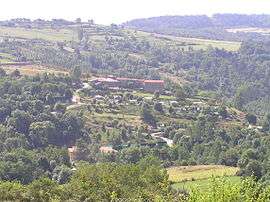
Petit Chaleat, in Eclassan | |
 Eclassan | |
|
Location within Auvergne-Rhône-Alpes region  Eclassan | |
| Coordinates: 45°09′32″N 4°45′43″E / 45.1589°N 4.7619°ECoordinates: 45°09′32″N 4°45′43″E / 45.1589°N 4.7619°E | |
| Country | France |
| Region | Auvergne-Rhône-Alpes |
| Department | Ardèche |
| Arrondissement | Tournon-sur-Rhône |
| Canton | Tournon-sur-Rhône |
| Intercommunality | Les Deux Rives de la Région de Saint-Vallier |
| Government | |
| • Mayor (2008–2014) | Jean-Daniel Combier |
| Area1 | 15.93 km2 (6.15 sq mi) |
| Population (2008)2 | 864 |
| • Density | 54/km2 (140/sq mi) |
| Time zone | CET (UTC+1) |
| • Summer (DST) | CEST (UTC+2) |
| INSEE/Postal code | 07084 / 07370 |
| Elevation |
273–530 m (896–1,739 ft) (avg. 400 m or 1,300 ft) |
|
1 French Land Register data, which excludes lakes, ponds, glaciers > 1 km² (0.386 sq mi or 247 acres) and river estuaries. 2 Population without double counting: residents of multiple communes (e.g., students and military personnel) only counted once. | |
Eclassan is a commune in the Ardèche department in southern France.
Population
| Historical population | ||
|---|---|---|
| Year | Pop. | ±% |
| 1962 | 528 | — |
| 1968 | 598 | +13.3% |
| 1975 | 533 | −10.9% |
| 1982 | 573 | +7.5% |
| 1990 | 633 | +10.5% |
| 1999 | 702 | +10.9% |
| 2008 | 864 | +23.1% |
See also
References
| Wikimedia Commons has media related to Eclassan. |
This article is issued from Wikipedia - version of the 10/28/2016. The text is available under the Creative Commons Attribution/Share Alike but additional terms may apply for the media files.