Vals-les-Bains
| Vals-les-Bains | ||
|---|---|---|
|
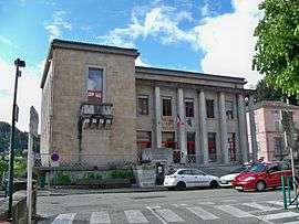
The town hall in Vals-les-Bains | ||
| ||
 Vals-les-Bains | ||
|
Location within Auvergne-Rhône-Alpes region  Vals-les-Bains | ||
| Coordinates: 44°39′59″N 4°22′01″E / 44.6664°N 4.3669°ECoordinates: 44°39′59″N 4°22′01″E / 44.6664°N 4.3669°E | ||
| Country | France | |
| Region | Auvergne-Rhône-Alpes | |
| Department | Ardèche | |
| Arrondissement | Largentière | |
| Canton | Vals-les-Bains | |
| Intercommunality | Pays d'Aubenas-Vals | |
| Government | ||
| • Mayor (2008–2014) | Jean-Claude Flory | |
| Area1 | 19.2 km2 (7.4 sq mi) | |
| Population (2008)2 | 3,737 | |
| • Density | 190/km2 (500/sq mi) | |
| Time zone | CET (UTC+1) | |
| • Summer (DST) | CEST (UTC+2) | |
| INSEE/Postal code | 07331 / 07600 | |
| Elevation |
250–985 m (820–3,232 ft) (avg. 328 m or 1,076 ft) | |
|
1 French Land Register data, which excludes lakes, ponds, glaciers > 1 km² (0.386 sq mi or 247 acres) and river estuaries. 2 Population without double counting: residents of multiple communes (e.g., students and military personnel) only counted once. | ||

Vals-les-Bains is a commune in the Ardèche department in southern France.
Population
| Historical population | ||
|---|---|---|
| Year | Pop. | ±% |
| 1793 | 2,063 | — |
| 1800 | 1,960 | −5.0% |
| 1806 | 2,090 | +6.6% |
| 1821 | 2,201 | +5.3% |
| 1831 | 2,355 | +7.0% |
| 1836 | 2,415 | +2.5% |
| 1841 | 2,789 | +15.5% |
| 1846 | 2,834 | +1.6% |
| 1851 | 2,875 | +1.4% |
| 1856 | 2,963 | +3.1% |
| 1861 | 2,800 | −5.5% |
| 1866 | 2,795 | −0.2% |
| 1872 | 3,240 | +15.9% |
| 1876 | 3,301 | +1.9% |
| 1881 | 3,410 | +3.3% |
| 1886 | 3,911 | +14.7% |
| 1891 | 3,684 | −5.8% |
| 1896 | 3,817 | +3.6% |
| 1901 | 4,025 | +5.4% |
| 1906 | 4,352 | +8.1% |
| 1911 | 4,414 | +1.4% |
| 1921 | 4,004 | −9.3% |
| 1926 | 4,218 | +5.3% |
| 1931 | 3,956 | −6.2% |
| 1936 | 3,691 | −6.7% |
| 1946 | 3,719 | +0.8% |
| 1954 | 3,843 | +3.3% |
| 1962 | 3,866 | +0.6% |
| 1968 | 4,190 | +8.4% |
| 1975 | 4,129 | −1.5% |
| 1982 | 3,933 | −4.7% |
| 1990 | 3,661 | −6.9% |
| 1999 | 3,536 | −3.4% |
| 2008 | 3,737 | +5.7% |
See also
References
| Wikimedia Commons has media related to Vals-les-Bains. |
This article is issued from Wikipedia - version of the 10/28/2016. The text is available under the Creative Commons Attribution/Share Alike but additional terms may apply for the media files.