Grospierres
| Grospierres | ||
|---|---|---|
|
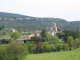
A general view of Grospierres | ||
| ||
 Grospierres | ||
|
Location within Auvergne-Rhône-Alpes region  Grospierres | ||
| Coordinates: 44°24′05″N 4°17′24″E / 44.4014°N 4.29°ECoordinates: 44°24′05″N 4°17′24″E / 44.4014°N 4.29°E | ||
| Country | France | |
| Region | Auvergne-Rhône-Alpes | |
| Department | Ardèche | |
| Arrondissement | Largentière | |
| Canton | Joyeuse | |
| Government | ||
| • Mayor (2008–2014) | Raymond Charousset | |
| Area1 | 27.3 km2 (10.5 sq mi) | |
| Population (2008)2 | 846 | |
| • Density | 31/km2 (80/sq mi) | |
| Time zone | CET (UTC+1) | |
| • Summer (DST) | CEST (UTC+2) | |
| INSEE/Postal code | 07101 / 07120 | |
| Elevation |
96–550 m (315–1,804 ft) (avg. 124 m or 407 ft) | |
|
1 French Land Register data, which excludes lakes, ponds, glaciers > 1 km² (0.386 sq mi or 247 acres) and river estuaries. 2 Population without double counting: residents of multiple communes (e.g., students and military personnel) only counted once. | ||

Grospierres is a commune in the Ardèche department in southern France.
Population
| Historical population | ||
|---|---|---|
| Year | Pop. | ±% |
| 1793 | 1,510 | — |
| 1800 | 863 | −42.8% |
| 1806 | 898 | +4.1% |
| 1821 | 1,049 | +16.8% |
| 1831 | 1,070 | +2.0% |
| 1836 | 1,158 | +8.2% |
| 1841 | 1,202 | +3.8% |
| 1846 | 1,216 | +1.2% |
| 1851 | 1,262 | +3.8% |
| 1856 | 1,275 | +1.0% |
| 1861 | 1,200 | −5.9% |
| 1866 | 1,173 | −2.2% |
| 1872 | 1,128 | −3.8% |
| 1876 | 1,023 | −9.3% |
| 1881 | 909 | −11.1% |
| 1886 | 894 | −1.7% |
| 1891 | 899 | +0.6% |
| 1896 | 908 | +1.0% |
| 1901 | 899 | −1.0% |
| 1906 | 909 | +1.1% |
| 1911 | 832 | −8.5% |
| 1921 | 732 | −12.0% |
| 1926 | 690 | −5.7% |
| 1931 | 625 | −9.4% |
| 1936 | 590 | −5.6% |
| 1946 | 579 | −1.9% |
| 1954 | 516 | −10.9% |
| 1962 | 472 | −8.5% |
| 1968 | 460 | −2.5% |
| 1975 | 426 | −7.4% |
| 1982 | 551 | +29.3% |
| 1990 | 507 | −8.0% |
| 1999 | 624 | +23.1% |
| 2008 | 846 | +35.6% |
See also
References
| Wikimedia Commons has media related to Grospierres. |
This article is issued from Wikipedia - version of the 10/28/2016. The text is available under the Creative Commons Attribution/Share Alike but additional terms may apply for the media files.