Saint-Julien-Labrousse
| Saint-Julien-Labrousse | |
|---|---|
|
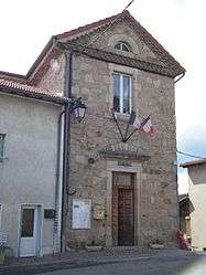
Town hall | |
 Saint-Julien-Labrousse | |
|
Location within Auvergne-Rhône-Alpes region  Saint-Julien-Labrousse | |
| Coordinates: 44°55′09″N 4°30′33″E / 44.9192°N 4.5092°ECoordinates: 44°55′09″N 4°30′33″E / 44.9192°N 4.5092°E | |
| Country | France |
| Region | Auvergne-Rhône-Alpes |
| Department | Ardèche |
| Arrondissement | Tournon-sur-Rhône |
| Canton | Cheylard |
| Intercommunality | Pays du Cheylard |
| Government | |
| • Mayor (2008–2014) | André Jouve |
| Area1 | 16.47 km2 (6.36 sq mi) |
| Population (2008)2 | 336 |
| • Density | 20/km2 (53/sq mi) |
| Time zone | CET (UTC+1) |
| • Summer (DST) | CEST (UTC+2) |
| INSEE/Postal code | 07256 / 07160 |
| Elevation |
315–899 m (1,033–2,949 ft) (avg. 763 m or 2,503 ft) |
|
1 French Land Register data, which excludes lakes, ponds, glaciers > 1 km² (0.386 sq mi or 247 acres) and river estuaries. 2 Population without double counting: residents of multiple communes (e.g., students and military personnel) only counted once. | |
Saint-Julien-Labrousse is a commune in the Hautes Alpes department in southern France.
Population
| Historical population | ||
|---|---|---|
| Year | Pop. | ±% |
| 1962 | 459 | — |
| 1968 | 515 | +12.2% |
| 1975 | 425 | −17.5% |
| 1982 | 355 | −16.5% |
| 1990 | 336 | −5.4% |
| 1999 | 318 | −5.4% |
| 2008 | 336 | +5.7% |
See also
References
| Wikimedia Commons has media related to Saint-Julien-Labrousse. |
This article is issued from Wikipedia - version of the 10/28/2016. The text is available under the Creative Commons Attribution/Share Alike but additional terms may apply for the media files.