Saint-Sauveur-de-Cruzières
| Saint-Sauveur-de-Cruzières | |
|---|---|
|
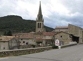
The church and surrounding buildings in Saint-Sauveur-de-Cruzières | |
 Saint-Sauveur-de-Cruzières | |
|
Location within Auvergne-Rhône-Alpes region  Saint-Sauveur-de-Cruzières | |
| Coordinates: 44°18′02″N 4°15′16″E / 44.3006°N 4.2544°ECoordinates: 44°18′02″N 4°15′16″E / 44.3006°N 4.2544°E | |
| Country | France |
| Region | Auvergne-Rhône-Alpes |
| Department | Ardèche |
| Arrondissement | Largentière |
| Canton | Vans |
| Intercommunality | Pays de Cruzières |
| Government | |
| • Mayor (2008–2014) | Christophe Champetier |
| Area1 | 24.84 km2 (9.59 sq mi) |
| Population (2008)2 | 542 |
| • Density | 22/km2 (57/sq mi) |
| Time zone | CET (UTC+1) |
| • Summer (DST) | CEST (UTC+2) |
| INSEE/Postal code | 07294 / 07460 |
| Elevation |
118–448 m (387–1,470 ft) (avg. 150 m or 490 ft) |
|
1 French Land Register data, which excludes lakes, ponds, glaciers > 1 km² (0.386 sq mi or 247 acres) and river estuaries. 2 Population without double counting: residents of multiple communes (e.g., students and military personnel) only counted once. | |
Saint-Sauveur-de-Cruzières is a commune in the Ardèche department in southern France.
Population
| Historical population | ||
|---|---|---|
| Year | Pop. | ±% |
| 1962 | 398 | — |
| 1968 | 431 | +8.3% |
| 1975 | 389 | −9.7% |
| 1982 | 409 | +5.1% |
| 1990 | 441 | +7.8% |
| 1999 | 501 | +13.6% |
| 2008 | 542 | +8.2% |
See also
References
| Wikimedia Commons has media related to Saint-Sauveur-de-Cruzières. |
This article is issued from Wikipedia - version of the 3/15/2016. The text is available under the Creative Commons Attribution/Share Alike but additional terms may apply for the media files.