Saint-André-en-Vivarais
| Saint-André-en-Vivarais | |
|---|---|
|
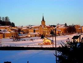
The church and surrounding buildings in winter | |
 Saint-André-en-Vivarais | |
|
Location within Auvergne-Rhône-Alpes region  Saint-André-en-Vivarais | |
| Coordinates: 45°07′19″N 4°24′43″E / 45.1219°N 4.4119°ECoordinates: 45°07′19″N 4°24′43″E / 45.1219°N 4.4119°E | |
| Country | France |
| Region | Auvergne-Rhône-Alpes |
| Department | Ardèche |
| Arrondissement | Tournon-sur-Rhône |
| Canton | Saint-Agrève |
| Intercommunality | Haut-Vivarais |
| Government | |
| • Mayor (2008–2014) | Charles Fouvet |
| Area1 | 20.48 km2 (7.91 sq mi) |
| Population (2008)2 | 230 |
| • Density | 11/km2 (29/sq mi) |
| Time zone | CET (UTC+1) |
| • Summer (DST) | CEST (UTC+2) |
| INSEE/Postal code | 07212 / 07690 |
| Elevation |
687–1,205 m (2,254–3,953 ft) (avg. 1,046 m or 3,432 ft) |
|
1 French Land Register data, which excludes lakes, ponds, glaciers > 1 km² (0.386 sq mi or 247 acres) and river estuaries. 2 Population without double counting: residents of multiple communes (e.g., students and military personnel) only counted once. | |
Saint-André-en-Vivarais is a commune in the Ardèche department in southern France.
Population
| Historical population | ||
|---|---|---|
| Year | Pop. | ±% |
| 1793 | 798 | — |
| 1800 | 630 | −21.1% |
| 1806 | 779 | +23.7% |
| 1821 | 425 | −45.4% |
| 1831 | 778 | +83.1% |
| 1836 | 913 | +17.4% |
| 1841 | 911 | −0.2% |
| 1846 | 1,005 | +10.3% |
| 1851 | 894 | −11.0% |
| 1856 | 857 | −4.1% |
| 1861 | 927 | +8.2% |
| 1866 | 900 | −2.9% |
| 1872 | 952 | +5.8% |
| 1876 | 1,000 | +5.0% |
| 1881 | 990 | −1.0% |
| 1886 | 1,064 | +7.5% |
| 1891 | 1,134 | +6.6% |
| 1896 | 1,102 | −2.8% |
| 1901 | 1,095 | −0.6% |
| 1906 | 1,101 | +0.5% |
| 1911 | 1,075 | −2.4% |
| 1921 | 908 | −15.5% |
| 1926 | 810 | −10.8% |
| 1931 | 787 | −2.8% |
| 1936 | 665 | −15.5% |
| 1946 | 617 | −7.2% |
| 1954 | 530 | −14.1% |
| 1962 | 485 | −8.5% |
| 1968 | 408 | −15.9% |
| 1975 | 319 | −21.8% |
| 1982 | 255 | −20.1% |
| 1990 | 213 | −16.5% |
| 1999 | 235 | +10.3% |
| 2008 | 230 | −2.1% |
See also
References
| Wikimedia Commons has media related to Saint-André-en-Vivarais. |
This article is issued from Wikipedia - version of the 10/28/2016. The text is available under the Creative Commons Attribution/Share Alike but additional terms may apply for the media files.