Faugères, Ardèche
| Faugères | |
|---|---|
|
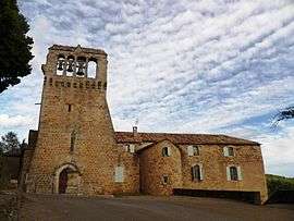
The church in Faugères | |
 Faugères | |
|
Location within Auvergne-Rhône-Alpes region  Faugères | |
| Coordinates: 44°28′32″N 4°08′11″E / 44.4756°N 4.1364°ECoordinates: 44°28′32″N 4°08′11″E / 44.4756°N 4.1364°E | |
| Country | France |
| Region | Auvergne-Rhône-Alpes |
| Department | Ardèche |
| Arrondissement | Largentière |
| Canton | Joyeuse |
| Intercommunality | Pays Beaume Drobie |
| Government | |
| • Mayor (2008–2014) | Christian Paladel |
| Area1 | 5.99 km2 (2.31 sq mi) |
| Population (2008)2 | 89 |
| • Density | 15/km2 (38/sq mi) |
| Time zone | CET (UTC+1) |
| • Summer (DST) | CEST (UTC+2) |
| INSEE/Postal code | 07088 / 07230 |
| Elevation |
299–811 m (981–2,661 ft) (avg. 400 m or 1,300 ft) |
|
1 French Land Register data, which excludes lakes, ponds, glaciers > 1 km² (0.386 sq mi or 247 acres) and river estuaries. 2 Population without double counting: residents of multiple communes (e.g., students and military personnel) only counted once. | |
Faugères is a commune in the Ardèche department in southern France.
Population
| Historical population | ||
|---|---|---|
| Year | Pop. | ±% |
| 1962 | 115 | — |
| 1968 | 122 | +6.1% |
| 1975 | 122 | +0.0% |
| 1982 | 120 | −1.6% |
| 1990 | 106 | −11.7% |
| 1999 | 101 | −4.7% |
| 2008 | 89 | −11.9% |
See also
References
| Wikimedia Commons has media related to Faugères, Ardèche. |
This article is issued from Wikipedia - version of the 10/28/2016. The text is available under the Creative Commons Attribution/Share Alike but additional terms may apply for the media files.