Saint-Julien-Vocance
| Saint-Julien-Vocance | |
|---|---|
|
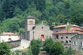
The church and surrounding buildings in Saint-Julien-Vocance | |
 Saint-Julien-Vocance | |
|
Location within Auvergne-Rhône-Alpes region  Saint-Julien-Vocance | |
| Coordinates: 45°10′34″N 4°30′14″E / 45.1761°N 4.5039°ECoordinates: 45°10′34″N 4°30′14″E / 45.1761°N 4.5039°E | |
| Country | France |
| Region | Auvergne-Rhône-Alpes |
| Department | Ardèche |
| Arrondissement | Tournon-sur-Rhône |
| Canton | Annonay-Sud |
| Intercommunality | Bassin d'Annonay |
| Government | |
| • Mayor (2008–2014) | Christian Archier |
| Area1 | 26.42 km2 (10.20 sq mi) |
| Population (2008)2 | 259 |
| • Density | 9.8/km2 (25/sq mi) |
| Time zone | CET (UTC+1) |
| • Summer (DST) | CEST (UTC+2) |
| INSEE/Postal code | 07258 / 07690 |
| Elevation |
569–1,388 m (1,867–4,554 ft) (avg. 670 m or 2,200 ft) |
|
1 French Land Register data, which excludes lakes, ponds, glaciers > 1 km² (0.386 sq mi or 247 acres) and river estuaries. 2 Population without double counting: residents of multiple communes (e.g., students and military personnel) only counted once. | |
Saint-Julien-Vocance is a commune in the Ardèche department in southern France.
Population
| Historical population | ||
|---|---|---|
| Year | Pop. | ±% |
| 1962 | 295 | — |
| 1968 | 370 | +25.4% |
| 1975 | 279 | −24.6% |
| 1982 | 269 | −3.6% |
| 1990 | 245 | −8.9% |
| 1999 | 241 | −1.6% |
| 2008 | 259 | +7.5% |
See also
References
| Wikimedia Commons has media related to Saint-Julien-Vocance. |
This article is issued from Wikipedia - version of the 10/28/2016. The text is available under the Creative Commons Attribution/Share Alike but additional terms may apply for the media files.