Salavas
| Salavas | ||
|---|---|---|
|
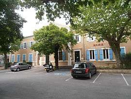
The town hall in Salavas | ||
| ||
 Salavas | ||
|
Location within Auvergne-Rhône-Alpes region  Salavas | ||
| Coordinates: 44°23′42″N 4°22′48″E / 44.395°N 4.38°ECoordinates: 44°23′42″N 4°22′48″E / 44.395°N 4.38°E | ||
| Country | France | |
| Region | Auvergne-Rhône-Alpes | |
| Department | Ardèche | |
| Arrondissement | Largentière | |
| Canton | Vallon-Pont-d'Arc | |
| Government | ||
| • Mayor (2008–2014) | Luc Pichon | |
| Area1 | 17.11 km2 (6.61 sq mi) | |
| Population (2008)2 | 532 | |
| • Density | 31/km2 (81/sq mi) | |
| Time zone | CET (UTC+1) | |
| • Summer (DST) | CEST (UTC+2) | |
| INSEE/Postal code | 07304 / 07150 | |
| Elevation |
80–522 m (262–1,713 ft) (avg. 96 m or 315 ft) | |
|
1 French Land Register data, which excludes lakes, ponds, glaciers > 1 km² (0.386 sq mi or 247 acres) and river estuaries. 2 Population without double counting: residents of multiple communes (e.g., students and military personnel) only counted once. | ||

Salavas is a commune in the Ardèche department in southern France.
Population
| Historical population | ||
|---|---|---|
| Year | Pop. | ±% |
| 1962 | 192 | — |
| 1968 | 240 | +25.0% |
| 1975 | 299 | +24.6% |
| 1982 | 355 | +18.7% |
| 1990 | 402 | +13.2% |
| 1999 | 504 | +25.4% |
| 2008 | 532 | +5.6% |
See also
References
| Wikimedia Commons has media related to Salavas. |
This article is issued from Wikipedia - version of the 2/11/2016. The text is available under the Creative Commons Attribution/Share Alike but additional terms may apply for the media files.