Pailharès
| Pailharès | |
|---|---|
|
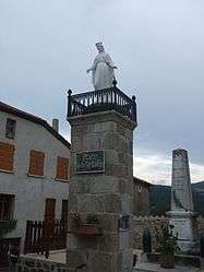
The fountain square and statue of the Virgin in Pailharès | |
 Pailharès | |
|
Location within Auvergne-Rhône-Alpes region  Pailharès | |
| Coordinates: 45°04′45″N 4°33′59″E / 45.0792°N 4.5664°ECoordinates: 45°04′45″N 4°33′59″E / 45.0792°N 4.5664°E | |
| Country | France |
| Region | Auvergne-Rhône-Alpes |
| Department | Ardèche |
| Arrondissement | Tournon-sur-Rhône |
| Canton | Saint-Félicien |
| Intercommunality | Pays de Saint-Félicien |
| Government | |
| • Mayor (2008–2014) | Jérôme Serayet |
| Area1 | 19.69 km2 (7.60 sq mi) |
| Population (2008)2 | 289 |
| • Density | 15/km2 (38/sq mi) |
| Time zone | CET (UTC+1) |
| • Summer (DST) | CEST (UTC+2) |
| INSEE/Postal code | 07170 / 07410 |
| Elevation |
496–1,184 m (1,627–3,885 ft) (avg. 700 m or 2,300 ft) |
|
1 French Land Register data, which excludes lakes, ponds, glaciers > 1 km² (0.386 sq mi or 247 acres) and river estuaries. 2 Population without double counting: residents of multiple communes (e.g., students and military personnel) only counted once. | |
Pailharès is a commune in the Ardèche department in southern France.
Population
| Historical population | ||
|---|---|---|
| Year | Pop. | ±% |
| 1962 | 581 | — |
| 1968 | 511 | −12.0% |
| 1975 | 402 | −21.3% |
| 1982 | 328 | −18.4% |
| 1990 | 285 | −13.1% |
| 1999 | 288 | +1.1% |
| 2008 | 289 | +0.3% |
See also
References
| Wikimedia Commons has media related to Pailharès. |
This article is issued from Wikipedia - version of the 2/12/2016. The text is available under the Creative Commons Attribution/Share Alike but additional terms may apply for the media files.