Sarras, Ardèche
| Sarras | |
|---|---|
|
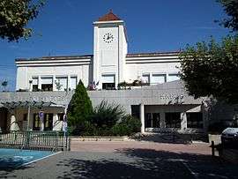
The town hall in Sarras | |
 Sarras | |
|
Location within Auvergne-Rhône-Alpes region  Sarras | |
| Coordinates: 45°11′16″N 4°47′57″E / 45.1878°N 4.7992°ECoordinates: 45°11′16″N 4°47′57″E / 45.1878°N 4.7992°E | |
| Country | France |
| Region | Auvergne-Rhône-Alpes |
| Department | Ardèche |
| Arrondissement | Tournon-sur-Rhône |
| Canton | Tournon-sur-Rhône |
| Intercommunality | Les Deux Rives de la Région de Saint-Vallier |
| Government | |
| • Mayor (2008–2014) | Jacques Alloua |
| Area1 | 11.65 km2 (4.50 sq mi) |
| Population (2008)2 | 2,065 |
| • Density | 180/km2 (460/sq mi) |
| Time zone | CET (UTC+1) |
| • Summer (DST) | CEST (UTC+2) |
| INSEE/Postal code | 07308 / 07370 |
| Elevation | 121–402 m (397–1,319 ft) |
|
1 French Land Register data, which excludes lakes, ponds, glaciers > 1 km² (0.386 sq mi or 247 acres) and river estuaries. 2 Population without double counting: residents of multiple communes (e.g., students and military personnel) only counted once. | |
Sarras is a commune in the Ardèche department in southern France.
Population
| Historical population | ||
|---|---|---|
| Year | Pop. | ±% |
| 1962 | 1,518 | — |
| 1968 | 1,555 | +2.4% |
| 1975 | 1,660 | +6.8% |
| 1982 | 1,669 | +0.5% |
| 1990 | 1,837 | +10.1% |
| 1999 | 1,829 | −0.4% |
| 2008 | 2,065 | +12.9% |
See also
References
| Wikimedia Commons has media related to Sarras, Ardèche. |
This article is issued from Wikipedia - version of the 10/28/2016. The text is available under the Creative Commons Attribution/Share Alike but additional terms may apply for the media files.