Saint-Barthélemy-le-Meil
| Saint-Barthélemy-le-Meil | |
|---|---|
|
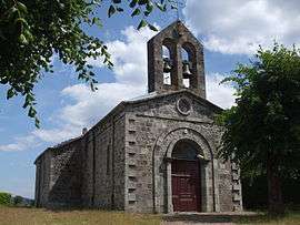
The church in Saint-Barthélemy-le-Meil | |
 Saint-Barthélemy-le-Meil | |
|
Location within Auvergne-Rhône-Alpes region  Saint-Barthélemy-le-Meil | |
| Coordinates: 44°53′08″N 4°29′56″E / 44.8856°N 4.4989°ECoordinates: 44°53′08″N 4°29′56″E / 44.8856°N 4.4989°E | |
| Country | France |
| Region | Auvergne-Rhône-Alpes |
| Department | Ardèche |
| Arrondissement | Tournon-sur-Rhône |
| Canton | Cheylard |
| Intercommunality | Pays du Cheylard |
| Government | |
| • Mayor (2008–2014) | René Julien |
| Area1 | 7.35 km2 (2.84 sq mi) |
| Population (2008)2 | 211 |
| • Density | 29/km2 (74/sq mi) |
| Time zone | CET (UTC+1) |
| • Summer (DST) | CEST (UTC+2) |
| INSEE/Postal code | 07215 / 07160 |
| Elevation |
340–800 m (1,120–2,620 ft) (avg. 500 m or 1,600 ft) |
|
1 French Land Register data, which excludes lakes, ponds, glaciers > 1 km² (0.386 sq mi or 247 acres) and river estuaries. 2 Population without double counting: residents of multiple communes (e.g., students and military personnel) only counted once. | |
Saint-Barthélemy-le-Meil is a commune in the Ardèche department in southern France.
Population
| Historical population | ||
|---|---|---|
| Year | Pop. | ±% |
| 1793 | 551 | — |
| 1800 | 456 | −17.2% |
| 1806 | 542 | +18.9% |
| 1821 | 506 | −6.6% |
| 1831 | 500 | −1.2% |
| 1836 | 526 | +5.2% |
| 1841 | 537 | +2.1% |
| 1846 | 565 | +5.2% |
| 1851 | 624 | +10.4% |
| 1856 | 647 | +3.7% |
| 1861 | 634 | −2.0% |
| 1866 | 650 | +2.5% |
| 1872 | 690 | +6.2% |
| 1876 | 630 | −8.7% |
| 1881 | 645 | +2.4% |
| 1886 | 709 | +9.9% |
| 1891 | 758 | +6.9% |
| 1896 | 742 | −2.1% |
| 1901 | 745 | +0.4% |
| 1906 | 707 | −5.1% |
| 1911 | 712 | +0.7% |
| 1921 | 607 | −14.7% |
| 1926 | 574 | −5.4% |
| 1931 | 531 | −7.5% |
| 1936 | 496 | −6.6% |
| 1946 | 396 | −20.2% |
| 1954 | 359 | −9.3% |
| 1962 | 317 | −11.7% |
| 1968 | 285 | −10.1% |
| 1975 | 239 | −16.1% |
| 1982 | 229 | −4.2% |
| 1990 | 223 | −2.6% |
| 1999 | 222 | −0.4% |
| 2008 | 211 | −5.0% |
See also
References
| Wikimedia Commons has media related to Saint-Barthélemy-le-Meil. |
This article is issued from Wikipedia - version of the 10/28/2016. The text is available under the Creative Commons Attribution/Share Alike but additional terms may apply for the media files.