Gluiras
| Gluiras | |
|---|---|
|
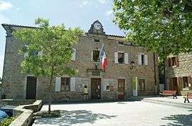
The town hall in Gluiras | |
 Gluiras | |
|
Location within Auvergne-Rhône-Alpes region  Gluiras | |
| Coordinates: 44°50′52″N 4°31′25″E / 44.8478°N 4.5236°ECoordinates: 44°50′52″N 4°31′25″E / 44.8478°N 4.5236°E | |
| Country | France |
| Region | Auvergne-Rhône-Alpes |
| Department | Ardèche |
| Arrondissement | Privas |
| Canton | Saint-Pierreville |
| Intercommunality | Châtaigniers |
| Government | |
| • Mayor (2008–2014) | Elisabeth Le Bournault |
| Area1 | 25.10 km2 (9.69 sq mi) |
| Population (2008)2 | 393 |
| • Density | 16/km2 (41/sq mi) |
| Time zone | CET (UTC+1) |
| • Summer (DST) | CEST (UTC+2) |
| INSEE/Postal code | 07096 / 07190 |
| Elevation | 219–1,046 m (719–3,432 ft) |
|
1 French Land Register data, which excludes lakes, ponds, glaciers > 1 km² (0.386 sq mi or 247 acres) and river estuaries. 2 Population without double counting: residents of multiple communes (e.g., students and military personnel) only counted once. | |
Gluiras is a commune in the Ardèche department in southern France.
Population
| Historical population | ||
|---|---|---|
| Year | Pop. | ±% |
| 1793 | 2,409 | — |
| 1800 | 2,074 | −13.9% |
| 1806 | 2,599 | +25.3% |
| 1821 | 2,583 | −0.6% |
| 1831 | 3,011 | +16.6% |
| 1836 | 3,019 | +0.3% |
| 1841 | 2,834 | −6.1% |
| 1846 | 2,927 | +3.3% |
| 1851 | 2,764 | −5.6% |
| 1856 | 2,867 | +3.7% |
| 1861 | 2,887 | +0.7% |
| 1866 | 2,673 | −7.4% |
| 1872 | 2,875 | +7.6% |
| 1876 | 2,857 | −0.6% |
| 1881 | 2,750 | −3.7% |
| 1886 | 2,757 | +0.3% |
| 1891 | 2,834 | +2.8% |
| 1896 | 2,665 | −6.0% |
| 1901 | 2,571 | −3.5% |
| 1906 | 2,515 | −2.2% |
| 1911 | 2,243 | −10.8% |
| 1921 | 1,863 | −16.9% |
| 1926 | 1,142 | −38.7% |
| 1931 | 1,080 | −5.4% |
| 1936 | 1,081 | +0.1% |
| 1946 | 906 | −16.2% |
| 1954 | 819 | −9.6% |
| 1962 | 713 | −12.9% |
| 1968 | 591 | −17.1% |
| 1975 | 452 | −23.5% |
| 1982 | 398 | −11.9% |
| 1990 | 380 | −4.5% |
| 1999 | 351 | −7.6% |
| 2008 | 393 | +12.0% |
See also
References
| Wikimedia Commons has media related to Gluiras. |
This article is issued from Wikipedia - version of the 10/28/2016. The text is available under the Creative Commons Attribution/Share Alike but additional terms may apply for the media files.