Saint-Symphorien-sous-Chomérac
| Saint-Symphorien-sous-Chomérac | |
|---|---|
|
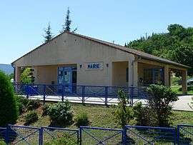
Town hall | |
 Saint-Symphorien-sous-Chomérac | |
|
Location within Auvergne-Rhône-Alpes region  Saint-Symphorien-sous-Chomérac | |
| Coordinates: 44°43′13″N 4°42′18″E / 44.7203°N 4.705°ECoordinates: 44°43′13″N 4°42′18″E / 44.7203°N 4.705°E | |
| Country | France |
| Region | Auvergne-Rhône-Alpes |
| Department | Ardèche |
| Arrondissement | Privas |
| Canton | Chomérac |
| Intercommunality | Barrès-Coiron |
| Government | |
| • Mayor (2008–2014) | Dominique Vignal |
| Area1 | 7.86 km2 (3.03 sq mi) |
| Population (2008)2 | 710 |
| • Density | 90/km2 (230/sq mi) |
| Time zone | CET (UTC+1) |
| • Summer (DST) | CEST (UTC+2) |
| INSEE/Postal code | 07298 / 07210 |
| Elevation |
110–394 m (361–1,293 ft) (avg. 200 m or 660 ft) |
|
1 French Land Register data, which excludes lakes, ponds, glaciers > 1 km² (0.386 sq mi or 247 acres) and river estuaries. 2 Population without double counting: residents of multiple communes (e.g., students and military personnel) only counted once. | |
Saint-Symphorien-sous-Chomérac is a commune in the Ardèche department in southern France.
Population
| Historical population | ||
|---|---|---|
| Year | Pop. | ±% |
| 1962 | 227 | — |
| 1968 | 246 | +8.4% |
| 1975 | 247 | +0.4% |
| 1982 | 381 | +54.3% |
| 1990 | 519 | +36.2% |
| 1999 | 684 | +31.8% |
| 2008 | 710 | +3.8% |
See also
References
| Wikimedia Commons has media related to Saint-Symphorien-sous-Chomérac. |
This article is issued from Wikipedia - version of the 10/28/2016. The text is available under the Creative Commons Attribution/Share Alike but additional terms may apply for the media files.