Lagorce, Ardèche
| Lagorce | |
|---|---|
|
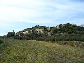
A general view of Lagorce | |
 Lagorce | |
|
Location within Auvergne-Rhône-Alpes region  Lagorce | |
| Coordinates: 44°26′55″N 4°25′05″E / 44.4486°N 4.4181°ECoordinates: 44°26′55″N 4°25′05″E / 44.4486°N 4.4181°E | |
| Country | France |
| Region | Auvergne-Rhône-Alpes |
| Department | Ardèche |
| Arrondissement | Largentière |
| Canton | Vallon-Pont-d'Arc |
| Government | |
| • Mayor (2008–2014) | Hervé Ozil |
| Area1 | 69.49 km2 (26.83 sq mi) |
| Population (2008)2 | 934 |
| • Density | 13/km2 (35/sq mi) |
| Time zone | CET (UTC+1) |
| • Summer (DST) | CEST (UTC+2) |
| INSEE/Postal code | 07126 / 07150 |
| Elevation |
96–700 m (315–2,297 ft) (avg. 130 m or 430 ft) |
|
1 French Land Register data, which excludes lakes, ponds, glaciers > 1 km² (0.386 sq mi or 247 acres) and river estuaries. 2 Population without double counting: residents of multiple communes (e.g., students and military personnel) only counted once. | |
Lagorce is a commune in the Ardèche department in southern France.
Geography
The village lies in the middle of the commune, on the right bank of the Salastre, a right tributary of the river Ibie, which flows south through the eastern part of the commune.
Population
| Historical population | ||
|---|---|---|
| Year | Pop. | ±% |
| 1962 | 417 | — |
| 1968 | 488 | +17.0% |
| 1975 | 507 | +3.9% |
| 1982 | 602 | +18.7% |
| 1990 | 706 | +17.3% |
| 1999 | 700 | −0.8% |
| 2008 | 934 | +33.4% |
See also
References
| Wikimedia Commons has media related to Lagorce, Ardèche. |
This article is issued from Wikipedia - version of the 10/28/2016. The text is available under the Creative Commons Attribution/Share Alike but additional terms may apply for the media files.