Uzer, Ardèche
| Uzer | |
|---|---|
|
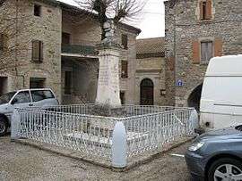
The war memorial in Uzer | |
 Uzer | |
|
Location within Auvergne-Rhône-Alpes region  Uzer | |
| Coordinates: 44°31′12″N 4°19′38″E / 44.52°N 4.3272°ECoordinates: 44°31′12″N 4°19′38″E / 44.52°N 4.3272°E | |
| Country | France |
| Region | Auvergne-Rhône-Alpes |
| Department | Ardèche |
| Arrondissement | Largentière |
| Canton | Largentière |
| Intercommunality | Val de Ligne |
| Government | |
| • Mayor (2008–2014) | Jean Monnier |
| Area1 | 3.51 km2 (1.36 sq mi) |
| Population (2008)2 | 419 |
| • Density | 120/km2 (310/sq mi) |
| Time zone | CET (UTC+1) |
| • Summer (DST) | CEST (UTC+2) |
| INSEE/Postal code | 07327 / 07110 |
| Elevation |
130–335 m (427–1,099 ft) (avg. 146 m or 479 ft) |
|
1 French Land Register data, which excludes lakes, ponds, glaciers > 1 km² (0.386 sq mi or 247 acres) and river estuaries. 2 Population without double counting: residents of multiple communes (e.g., students and military personnel) only counted once. | |
Uzer is a commune in the Ardèche department in southern France.
Population
| Historical population | ||
|---|---|---|
| Year | Pop. | ±% |
| 1962 | 259 | — |
| 1968 | 274 | +5.8% |
| 1975 | 305 | +11.3% |
| 1982 | 337 | +10.5% |
| 1990 | 368 | +9.2% |
| 1999 | 336 | −8.7% |
| 2008 | 419 | +24.7% |
See also
References
| Wikimedia Commons has media related to Uzer, Ardèche. |
This article is issued from Wikipedia - version of the 7/16/2016. The text is available under the Creative Commons Attribution/Share Alike but additional terms may apply for the media files.