Mauves
| Mauves | |
|---|---|
|
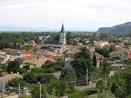
The church and surrounding buildings in Mauves | |
 Mauves | |
|
Location within Auvergne-Rhône-Alpes region  Mauves | |
| Coordinates: 45°02′21″N 4°49′48″E / 45.0392°N 4.83°ECoordinates: 45°02′21″N 4°49′48″E / 45.0392°N 4.83°E | |
| Country | France |
| Region | Auvergne-Rhône-Alpes |
| Department | Ardèche |
| Arrondissement | Tournon-sur-Rhône |
| Canton | Tournon-sur-Rhône |
| Intercommunality | Tournon |
| Government | |
| • Mayor (2008–2014) | Jean-Louis Cordola |
| Area1 | 7.05 km2 (2.72 sq mi) |
| Population (2008)2 | 1,151 |
| • Density | 160/km2 (420/sq mi) |
| Time zone | CET (UTC+1) |
| • Summer (DST) | CEST (UTC+2) |
| INSEE/Postal code | 07152 / 07300 |
| Elevation |
113–432 m (371–1,417 ft) (avg. 123 m or 404 ft) |
|
1 French Land Register data, which excludes lakes, ponds, glaciers > 1 km² (0.386 sq mi or 247 acres) and river estuaries. 2 Population without double counting: residents of multiple communes (e.g., students and military personnel) only counted once. | |
Mauves is a commune in the Ardèche department in southern France. It is about 10 km north of Valence and 75 km south of Lyon.
Population
| Historical population | ||
|---|---|---|
| Year | Pop. | ±% |
| 1962 | 621 | — |
| 1968 | 663 | +6.8% |
| 1975 | 756 | +14.0% |
| 1982 | 923 | +22.1% |
| 1990 | 1,027 | +11.3% |
| 1999 | 1,094 | +6.5% |
| 2008 | 1,151 | +5.2% |
See also
References
| Wikimedia Commons has media related to Mauves. |
This article is issued from Wikipedia - version of the 10/28/2016. The text is available under the Creative Commons Attribution/Share Alike but additional terms may apply for the media files.